rragan
-
Posts
1003 -
Joined
-
Last visited
-
Days Won
75
Everything posted by rragan
-
I listened to a Podcast about Geooh Live, an Android app. While Android users may have Cachly-envy, the reverse is also true. Here are Geooh features I'd love to see in Cachly. Google Street View integration KML and GeoJSON overlays on maps (provides DeLorme), county boundaries. User would download and specify overlays to use Optional sounds to play for logging a Found and DNF. Just a fun thing Integrated Wherigo player (low priority) Show optimized cache visit route for a list of caches. Done by reaching out to Google for the heavy lifting Named filter lists that can be saved and reused Nearby cache notifications See Cachly Friends logs on a cache. This would be limited to the logs the API allows access to or is offline but could still be very handy
- 1 reply
-
- 1
-

-
Watch 2 has the needed GPS so LTE only would add Live updates. A Watch2 synced with a list on the phone would be nearly as good.
-
You can Airdrop offline lists between devices via Export. I often plan things on the iPad and export the plan list to the iPhone for execution.
-
Right now locations are very handy but second class citizens. I've suggested to Nic that moving them towards user-defined local caches would help in many ways. Associated with a list exportable filterable navigate to...
-
Unless you explicitly kill off other apps, they tend to stack up over time. The ones to be concerned about are those running in background mode as they do take resources.
-
GPS not working when phone has No Service
rragan replied to Nic Hubbard's topic in General Questions
I ran Cachly in Airplane mode on a small plane flight from Victoria to Seattle and used the GPS to track the flight path and ground features all the way. I'm sure there were no cell towers much of the way and airplane mode disabled the cell radio anyway. Other than a slight lag discrepancy between what the the position on the offline map showed and what was right under the plane, I never saw any problem. -
I don't use c:Geo but I'm curious if it deals with the older logs when scraping. In typical web use, logs are added to the page as you scroll down or ask for more logs.
-
Yeh, I keep putting off using GSAK. I could easily put a VM on the Mac or boot to the Windows partition lying there. I don't foresee any issues figuring out GSAK -- my geek cred is strong. Thanks. Maybe I'll go that route vs writing some node JS code to push them via the web.
-
I'm not a GSAK user
-
This is not specifically Cachly's problem but it confused me greatly. Here is the story. Geosphere shows corrected coordinates but never uploaded them to the website because the API likely didn't support it then. I'm trying to move my solved puzzles with CCs to Cachly and then push the CC to the website for more permanence. I do the export/ import and Cachly shows the CC icon and the corrected coordinate value. The only Waypoints shown is one for the original location and nothing for the CC. Updating from the site changes nothing. If I add a Waypoint for CC, then the website gets the data finally As best I can see from the GPX the wpt tag has the CC value and the gsak:LatBeforeCorrect tag has the original Lat coordinate and similarly for Longitude I think these "Before" tags populate the Original Coordinate Waypoint in Cachly. I guess the prescence of these also trigger the red triangle display even though there is no CC Waypoint explicitly. <wpt lat="37.553917" lon="-122.094833"><time>2011-01-08T08:00:00Z</time><name>GC2M72Q</name><desc>Programming Challenge Puzzle Series: Level 4 by mokelly, Unknown Cache (3/3)</desc><url>http://coord.info/GC2M72Q</url><urlname>Programming Challenge Puzzle Series: Level 4</urlname><sym>Geocache Found</sym><type>Geocache|Unknown Cache</type><gsak:wptExtension xmlns:gsak="http://www.gsak.net/xmlv1/5"><gsak:UserFlag>true</gsak:UserFlag><gsak:DNF>false</gsak:DNF><gsak:LatBeforeCorrect>37.55365</gsak:LatBeforeCorrect><gsak:LonBeforeCorrect>-122.080566</gsak:LonBeforeCorrect><gsak:LastGpxDate>2017-08-04</gsak:LastGpxDate><gsak:Code>GC2M72Q</gsak:Code><gsak:IsPremium>false</gsak:IsPremium><gsak:FavPoints>9</gsak:FavPoints><gsak:GcNote>N 37 33.235 W 122 05.69 Having the CC data only local to the Cachly DB propagates the failings of Geosphere and retains the risk of losing puzzle solutions if the local DB gets lost. It's not really Cachly's problem and I'm willing to plow through all 300+ solved puzzles and make them have true corrected coords on the website. Just wondering how many others may have this issue and not realize it and whether there is any easy fix to make the website reflect what Cachly shows? The little red triangle makes you think all is well when it may not be.
-
Safari recognizes the meta information in the download and knows it is a GPX so offers apps that can handle GPX. Chrome, as best I can tell, only looks at the file extension and these lack that. Always use Safari for downloading GPX from web to Cachly.
- 26 replies
-
- 1
-
-
- gpx
- lab caches
- (and 3 more)
-
Indicate caches that are in an offline list
rragan replied to RestoRanger's question in Feature Requests
Putting all Live results into the DB would make this moot and resolve inconsistencies that might arise between the DB and the Live version. Other good benefits could result. -
While we're talking fancy UI, how about an UNDO shake on the map/compass page to show the hint. Handy if your Geosenses fail you and you want a quick peek.
-
Ok, let's brute force it. Find ALL caches with corrected coordinates and load them into Cachly. Now if Nic just had an offline filter by distance, you could extract all of those at a desired distance. Now that the web site shows CCs, I'm not sure how the search treats them. It might find them at the true location.
-
I sometimes take this route when other tools like Map Compare need to be employed.
-
Re DT looping. Here is what I do. Generally, I know I'm not going to find much locally as I've consumed the hard to get ones already in an earlier loop. Therefore, I only worry about this when I go travelling. So if I'm off to Oregon and working on loop 3, I'll make a list of all DT combos showing a 2. Then I use the geocaching.com search filter for Oregon for only that combo. Using the map view, I inspect those candidates near where I will go and add them to a list named OregonDT3. Rinse and Repeat for other needed DT combos. In the end, I have a bookmark list for all the needed DT combos I might try for on the trip. Import into Cachly and off I go. I could use Project-GC but I prefer to cherry pick as part of trip planning -- the same reason I don't use Caches Along A Route PQ.
-
Would something like a unix strings command on the DB show log text allowing some manual recovery even if the logs would need to be reentered?
-
Glad my stats could be of assistance. Yes loop 3 is on my task list and I have an offline list to work from. I can't say I ever would look 2 or 3 loops ahead except for Jasmer which is more opportunistic grabbing rather than planned trips for just that purpose. Cachly should aid in the execution of plans and cache finding but most planning belongs to other tools.
-
You can only open a single selected cache on Geocaching.com. There is no way to see all the offline caches in a map on Geocaching.com. Just one at a time.
-
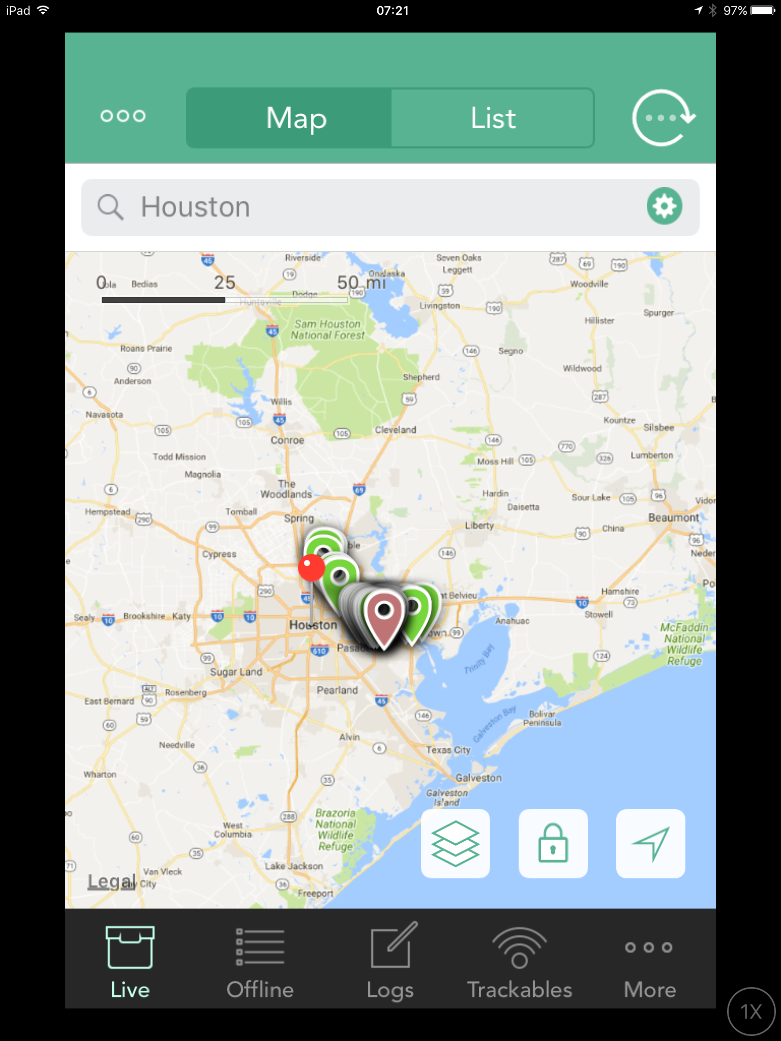
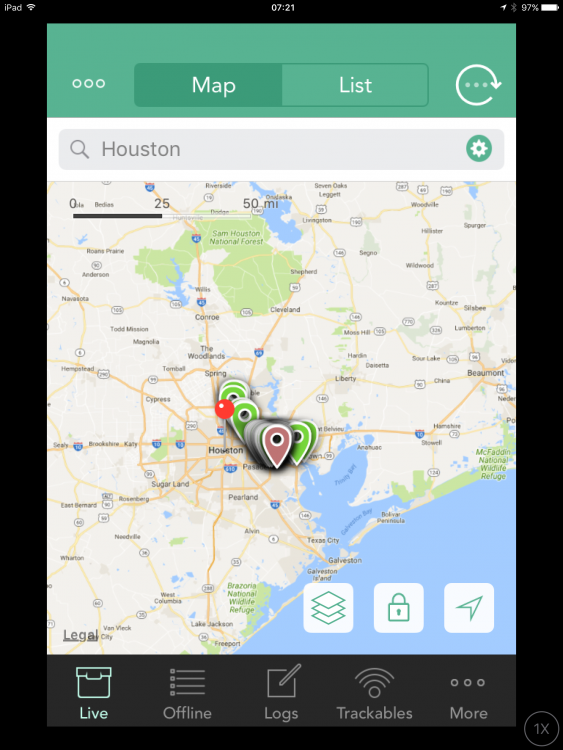
How did you add the GPX file? Cachly needs to run its import process to put the GPX info into its database. GPX files can be imported from email. Dropbox, bookmark lists, inter-app transfer using the Send icon (rectangle with arrow exiting the top), AirDrop from another phone/pad or Mac and probably some other ways I forgot. I don't think you can drop them in via iTunes to Cachly's file space. If you are migrating from Geosphere, it supported importing a GPX file via iTunes. To my knowledge, Cachly does not yet have such a mechanism but it should probably go on the wanted feature list Also, the screen capture shows the Live view and would not reflect your GPX import. That would be chosen from a named list on the Offline tab. The appearance of only 3 caches makes me suspect you are not a premium member. Geocaching.com restricts non-premium members to 3 caches per day via the Live mechanism. I recreated your map view and hit the refresh arrow and got 50 caches. See screen capture.
-
You could probably work around this by doing a 2.5 km radius search on the web site and save all the results to a list and then import the list to Cachly.
-
GPS not working when phone has No Service
rragan replied to Nic Hubbard's topic in General Questions
GPS should be on in airplane mode. https://www.macobserver.com/analysis/ios-airplane-mode-gps-nfc/ But if you have turned off location services, I believe that shuts it off. -
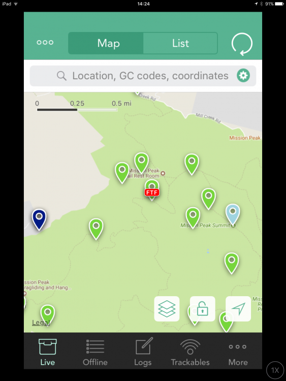
FTF looks like this
-
You can use Settings -> General -> Keyboard -> Text Replacement to create text presets so "paf" followed by a space would instantly expand to your Phone A Friend message. I used to use "sl" for SL TFTC until I decided that was a poor log to reward someone's hard work to create it. Just choose your abbreviation so it is not a word you would ever type normally or you will get surprised.
-
Maybe archived can be resurrected but PA is dead forever?