Nic Hubbard
-
Posts
3836 -
Joined
-
Last visited
-
Days Won
388
Everything posted by Nic Hubbard
-

Pins or similar for all pending clues
Nic Hubbard replied to barefootguru's question in Feature Requests
I have considered using iCloud for features like this. They would be synced across all devices that use your iCloud account (if you login to iCloud). However, this would likely be a 2.2 or 3.0 feature. -
Will see about getting this added into a future version.
-
Pins or similar for all pending clues
Nic Hubbard replied to barefootguru's question in Feature Requests
This could be an easy feature to enhance. -
It worked correctly for me. Are you using an iPad?
-
So sorry about that.
-
Cachly supports background downloading of offline maps. However sometimes iOS will pause a download and there will be missing data when it is resumed. Try downloading it again keeping your phone from locking and it should work.
-
Cachly is a third-part geocaching.com app and is therefore also bound by the terms and restrictions of the API that geocaching.com provides. This sadly means that they limit what Regular users see, e.g. only Traditional caches, limited searching, etc. To be clear, this is NOT a limitation of Cachly, but a limitation of the geocahing.com API for Regular users. ** Note: The Classic app used a modified API that we don't have access to. I wish there was a way to provide a better experience for Regular users.
-
Are you asking if it is possible to show the radius around all waypoints of a cache?
-
We don't force your phone to stay awake since as you mentioned, there is an iOS setting for this. If we forced the phone not to sleep, user might leave Cachly open expecting iOS to sleep their phone at the chosen interval, but instead it would just waste their battery keeping the screen on. However, adding this feature to the Navigate screen might be beneficial since this is likely the screen that users would be using a lot.
-
This is on our feature list, but I don't know if it will make it into 2.1.
-
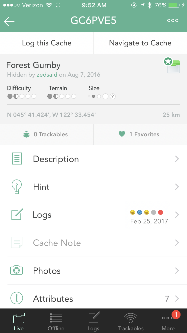
Did you see the updated screenshot I posted?
-
So glad to hear it!
-
In Settings there is an option to "Rebuild DNF Database". This will gather your DNFs from geocaching.com again and should correct your issue.
-
Cachly 2.1 and map clustering input needed
Nic Hubbard replied to Nic Hubbard's topic in General Questions
This is key. It is the amount of caches/pins on the map, and doesn't really matter the map span. Clustering should solve this, as it can be turned on and off based on what zoom level the user is at, which should solve pretty much all the problems, including memory. -
Cachly 2.1 and map clustering input needed
Nic Hubbard replied to Nic Hubbard's topic in General Questions
I think regardless of the viewing size, if it is a full country, state or even just a city that the solution I posted proves to be interesting, but not practical. It was fun to build, but as much as I would like to be able to implement a simple solution like this, I can see how it won't work. -
Cachly 2.1 and map clustering input needed
Nic Hubbard replied to Nic Hubbard's topic in General Questions
I think that this solution, as pointed out, doesn't solve the problem in a good way. Back to the drawing board and working with clustering code... -
Cachly 2.1 and map clustering input needed
Nic Hubbard replied to Nic Hubbard's topic in General Questions
Playing with an alternative to clustering. This loads x number of caches at a time, and tapping a button allows you to load the next x number of caches. It is really easy to cycle through 7543 caches in about 10 seconds. This also keeps memory low because all pins are never loaded on the map. Thoughts on this proof of concept? -
Will reply to your email.
-
This is the current behavior. Although as others mentioned if it detects a small amount of signal it will try to upload. When there is no connection it will save the Waypoint offline and then upload that waypoint at a later time (if you return to Cachly later with an internet connection they will be uploaded).
-
The original colors in Cachly (besides found and DNF) were based off of the geocaching.com icons. The archive icon is red, so that is where the color was sampled from.
-
I have not changed it from red yet. Did you think it deserved a different color?
-
Posting this for more discussion. Thoughts? P.S., this is starting to grow on me...
-
Great idea!
-
The Series 2 doesn't have a compass.
-
Removal of duplicate pending found log removes checkmark
Nic Hubbard replied to bloodycool's topic in Support
Thanks for reporting this. Will get it added to the bug tracker.