Nic Hubbard
-
Posts
3973 -
Joined
-
Last visited
-
Days Won
409
Everything posted by Nic Hubbard
-
This is helpful, and I have seen this issue reported many times over the last year. The issue is, this is a API bug where one of the requests is returning a timeout error. I have reported this to HQ many times, but they say they cannot replicate it.
-
Nope. They will continue to be separate apps.
-
Do you have the GC code so I can take a look?
-
This issue should be fixed now.
-
This is an API bug and has been reported to HQ. In the meantime please turn off filtering.
-
This has been fixed. Sorry about this issue!
-
This is a geocaching.com API error which has been reported to them. Hoping it will get fixed soon.
-
This will be fixed in a 7.1.3 update very soon.
-

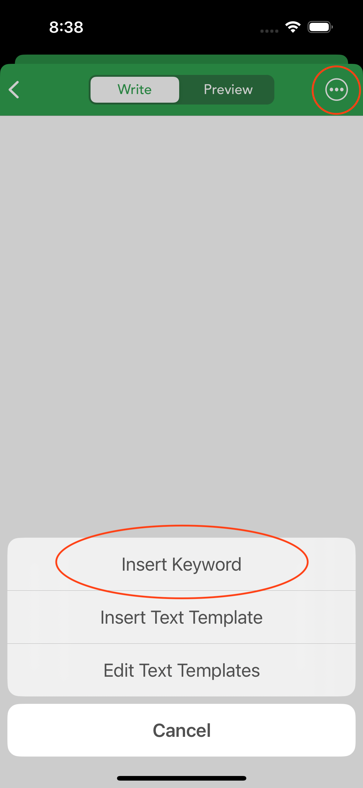
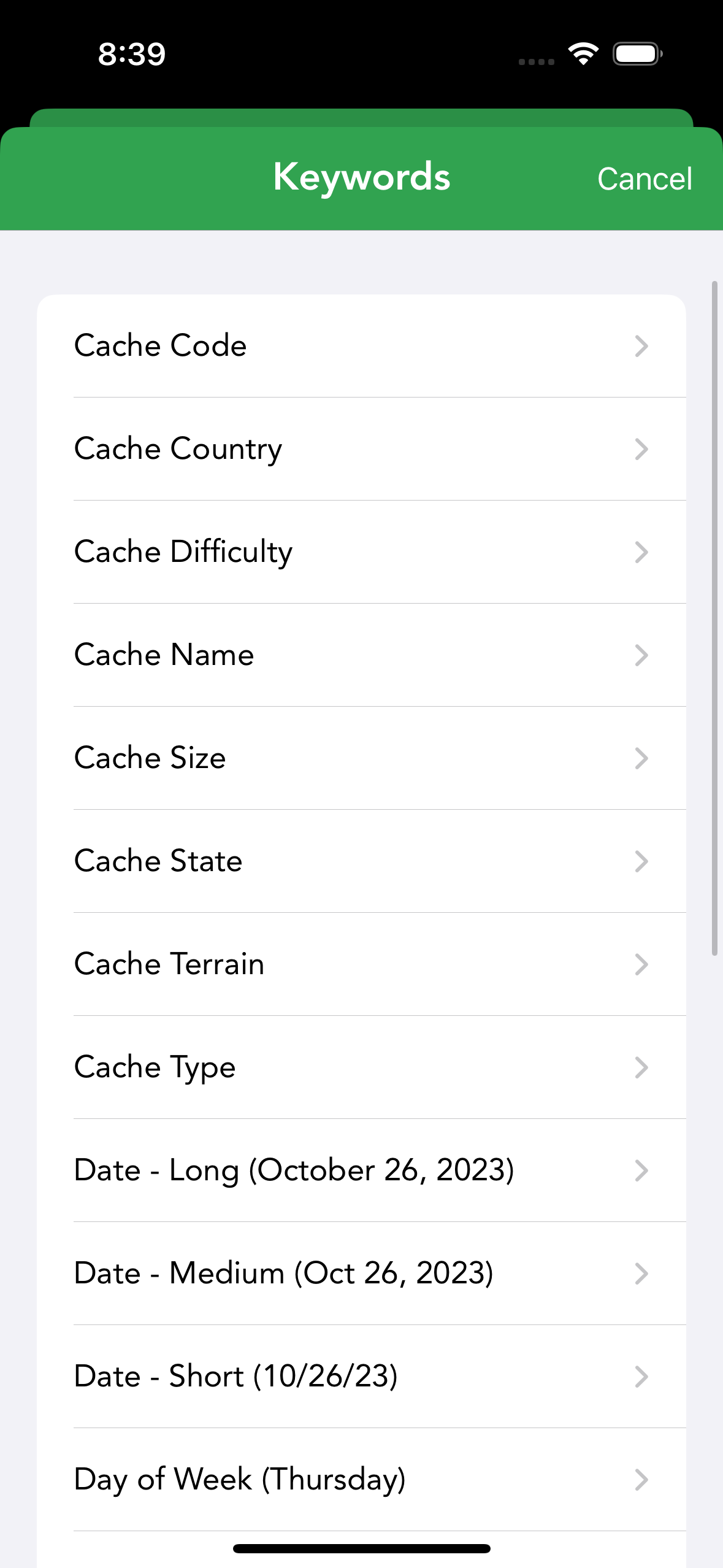
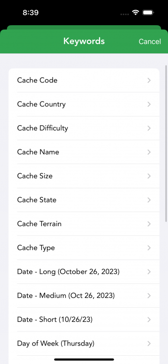
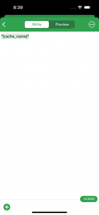
templates Are there placeholders in the templates?
Nic Hubbard replied to Oli's topic in General Questions
Yes. When you are entering a log (or create a text template) you can insert keywords. Just tap the ... button:
-
Premium Offline Maps with LIDAR Hillshading
Nic Hubbard replied to Udo's question in Feature Requests
I would need Lidar shading files of the entire world. This would then take a huge amount of time to process them correctly for use in Cachly, so I don't plan to do that at this time. -
Cachly already uses OAuth 2.0 in 7.x and we will be adding the PKCE requirement in an upcoming 7.x fix and in 8.0. So, not to worry!
- 1 reply
-
- 2
-

-
The feature is planned for Cachly 8.1 as our 8.0 version has already had a feature freeze. Stay tuned.
-
No, I do not want to mix the API's or the apps. This would be a much too bloated app.
-
This is actually a feature of 8.0 where you will be able to tap a download button in Cachly and the Wherigo app will open and then download that cartridge.
- 1 reply
-
- 1
-

-
This is not as easy as you think and would take a huge amount of work. This isn't a priority, but I won't rule it out.
-
What is the format of the waypoints? Cachly expects the GPX file to have geocaches with waypoints associated, not just waypoints as standalone.
-
Can you explain a bit more what you mean?
-
HQ has said they are still looking into the issue.
-
Just wanted to let you know that this has been fixed in Cachly 8.0.
-
8.0 is being worked on actively, but we don't have a release date.
-
Yes, this is possible. We add this to our feature list for consideration.
- 1 reply
-
- 1
-
-
I have considered this, but don't yet have it planned.
-
Can you explain this a bit more on how this works? Just a reminder that c:geo is not a geocaching.com partner app, and they grab data from the website in ways that I cannot, so we might not be able to do what they do.
-
This is intentional. The API is rate limited and you can only do a limited amount of requests per 60 seconds.
-
Hmm, are you using the same App Store account?