

Nic Hubbard
-
Posts
3971 -
Joined
-
Last visited
-
Days Won
409
Posts posted by Nic Hubbard
-
-
Yes it should. Will log this as a bug.
-
Great discussion. This would be an easy change on my end, but I would like to hear what others think.
-
When you load caches onto the Live map, the API is performing a search. So it applies in this situation.
")
-
Cool idea. In the meantime, just wanted to make sure you knew that you can copy additional details from the "Additional Information" screen.
-
Thanks for letting me know Stephen, will look into the issue of Netherlands and Germany not downloading.
-
This is something we have planned and is on our feature list. Hopefully we can get it added soon.
-
6 hours ago, rragan said:
maybe ought to have an X on top of it? I guess there is the general question of icon treatment when archived and when disabled.
I will add these ideas to our feature list. Thanks!
-
Absolutely. This is something that I have already added in for 2.0.3. Here are some screenshots:
- Team DEMP and hidegoseek
-
 2
2
-
Great suggestion. There isn't currently a visual suggestion for this. Are you seeing Archived caches on the map other than the random archived Event cache?
-
13 minutes ago, TheGreenTroll said:
I struggle to see the pin colour difference between unknowns and wherigo's and now highlight wherigo's so it's easy to distinguish them.
This is a situation where I wouldn't mind changing the color for all Cachly users.
-
8 minutes ago, TheGreenTroll said:
I'm liking the new time setting in 2.0.2, it works a treat and a great addition to the app.
Wonderful! Glad it is working well for you. We have had users from all across the world test it and it seems to be having no issues.
-
2 minutes ago, ThePinkTeaspoon said:
With the proposed bulk logging is it a case of the app sending all pending logs or will the user be able to select which logs they would just like to send?
The feature will be to send all pending logs, but in the future it wouldn't be too hard to allow the user to choose which ones they want to send as well.
-
11 hours ago, rragan said:
Offhand I can't think how pin color in map view would be key to understanding a support problem. I'm not suggesting changing the full icon color. Can you explain how it would help resolve an issue?
I just feel it would cause some confusion. I realize this is a personal preference thing, and I realize that if users came from Geosphere they might be used to this feature. It just isn't something that I want to make a priority in Cachly.
The pin colors are also pretty deeply integrated in Cachly, so this wouldn't be a quick and easy feature to add.
-
4 hours ago, J&J Team Yukon said:
I get the calibration screen several times while we are out caching. Wondering why.
You can turn the calibration option off in Settings. iOS controls the display of the calibration screen, so sadly we don't have any control over how often it shows. It will shown when iOS "thinks" it needs to recalibrate. Feel free to turn it off in the Cachly Settings.
-
Just to open up a discussion, the problem I see with this is consistency. If users are able to change the map pins to whatever colors they like, support would become difficult when viewing screenshots if all pins are different colors from what we designed them to be.
The pin colors were designed after the corresponding cache type icons, so each takes colors from that.
-
This is a harder one to support because all elements of the design need to account for the text getting larger, so things need to shift, move and reposition based on the size of text. Which, is very hard in layouts such as list view where we try to pack as much info in as possible.
I do have this on our list and it is something I am still considering the best way to approach.
-
-
-
-
Looking at our crash logs, I do see some crashes for your user on January 2, but none since then. One Jan. 2 they were being caused by the map issue when navigating that I outlined elsewhere.
Are you able to replicate any of these crashes reliably?
-
Have it on our feature list. Will bump it up a bit in priority.
-
This is one of those issues that is hard to fix and make everyone happy. Our current UI design is a good mix of information that most of our users find helpful. I would think that you are in the "power user" category, so your requirements are somewhat different.
I think in the future maybe having two different UI layouts for list/map callout would be a good idea. So I will make sure it gets noted on our feature list.
-
-
Are you on 2.0.2?
8 hours ago, Diadem said:About map rendering, I notice that Cachly re-renders when returning to a map view (i.e. back from a cache listing to the map of nearby caches). I had wondered why Cachly didn't retain and reuse the rendered tiles as I haven't moved in the 30secs since I left the map view.
Tile caching is enabled. Are you seeing the issue when you move from one offline map to another? (Such as from an offline list map to the navigate map inside of a cache?)
My Multi's Waypoints
in Feature Requests
Posted
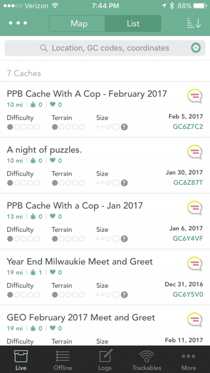
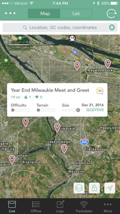
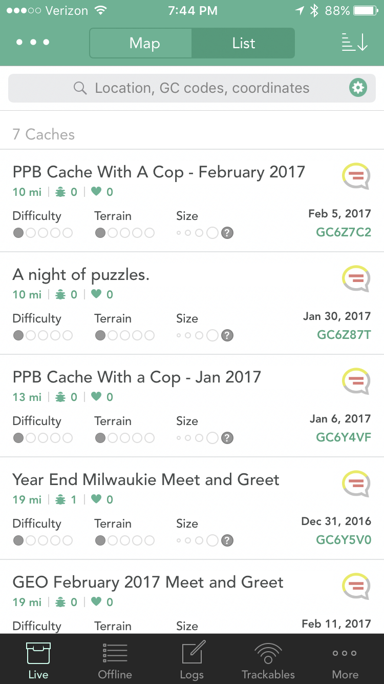
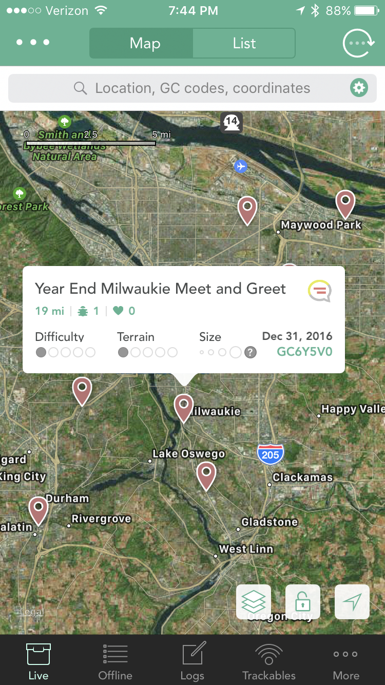
They should be showing. What is the GC code?