Nic Hubbard
-
Posts
3973 -
Joined
-
Last visited
-
Days Won
409
Everything posted by Nic Hubbard
-
Yes, it will go into effect on May 8th.
-
This email was sent to all API partners. I have sent some further questions to clarify some things, but overall I hope that these will be good changes for users.
-

How do you center the map on a city or zip?
Nic Hubbard replied to .jpeg's topic in General Questions
Great idea. Will do! -
How do you center the map on a city or zip?
Nic Hubbard replied to .jpeg's topic in General Questions
This isn't a seach by Cache code option. That is always available when this option is off. This search by cache name is just that. A search for the name of a cache within a 50k meter radius. (API limit) -
How do you center the map on a city or zip?
Nic Hubbard replied to .jpeg's topic in General Questions
Nope. Glad we got it figured out. Thanks @Team DEMP! -
How do you center the map on a city or zip?
Nic Hubbard replied to .jpeg's topic in General Questions
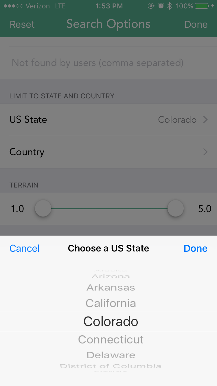
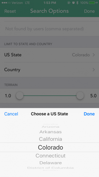
Have you tried resetting your Search Options? -
How do you center the map on a city or zip?
Nic Hubbard replied to .jpeg's topic in General Questions
Can you send me debug data? Just use the contact support option in the More tab. Also, try clearing the search options, you shouldn't have to do this, but I am not sure why this is happening for you. -
How do you center the map on a city or zip?
Nic Hubbard replied to .jpeg's topic in General Questions
That search worked for me and took me to Dallas. Your map should have moved to the location before even making a request for caches, so that is strange. Does this happen each time you search for a zip code? -
I think this comes down to personal preference. I will make sure to make a note of this so we can evaluate the request.
-
How do you center the map on a city or zip?
Nic Hubbard replied to .jpeg's topic in General Questions
Yes, you can just enter that into the Live tabs search field and Cachly will take you to that location. -
Strangely in iOS this is no easy task to do for an entire app. However, a friend of mine Gary Slinkard had also requested this a while ago, so I have completed development of this feature in my current alpha version.
-
How it currently works is how the default is for iOS. This is the same as how the Apple Maps application works. I do however realize it is a pain for users. It isn't a quick and easy fix on our end and is something that we have to develop our own solution for, but we will be working on getting this done in an upcoming version. iOS is what prompts that screen to show. It will show when iOS thinks it has encountered a magnetic field change. This could be because your phone is close to electronics or even a large chunk of metal like a car. Because of this there is a Settings option in Cachly to turn this off.
-
Yes. I have actually just finished implementing this feature in 2.1. It is very cool! Can't wait to let others give it a try. Didn't realize there were caches in Antartica!
-
I have tested this and cannot reproduce the issue. Are you still able to? What version of Cachly are you using?
-
I just got word from Groundspeak that this issue should be fixed. Could you try again?
-
The thing that is frustrating about this is that the API still only returns 50 caches at a time. I wish there was a way to load all friend caches at once and then save those to a list...
-
This is a geocaching.com API error that just started occurring. I have reported it to Groundspeak and hopefully it will get fixed ASAP.
-
So glad to hear that it worked! I will make sure to fix the slash in the username issue in 2.1!
-
This functionality has already been completed in the brand new coordinate parser in 2.1. Detection of coordinates in all formats will also be across the app.
-
Thanks. I will add the disabling the red line to our list of features for evaluation.
-
This is just a Cachly style which our users love. I think the pins in Geosphere feel like an old iOS style since many apps have moved away from this. I understand if it is hard to get used to something new. Other Geosphere users have suggested this. We have considered this and it is still on our feature list. Do you mean coordinates in the log text itself, or coordinates that were submitted with the log? Do you have a GC code I can look at? Yes, this will be coming in 2.1. In 2.1 we will be using a unified database. So caches in one offline list will be the same database record in another list. This will be the same as "groups". Let me know if you have any other questions.
-
This is a nice feature, but not one that we are likely to support right now. Cachly was built from a single user prospective so it would take a fair amount of work to change this. But it is on our list to consider for a future version.
-
This is a known issue that was just introduced recently by one of our map providers. It doesn't affect the map display at all and will be fixed in 2.1.
-
Stop searching for nearby caches automatically
Nic Hubbard replied to Accoue's question in Feature Requests
This has been requested by other users. We are planning to make it an option that you can turn off in Settings. -
Thanks. Will do some digging into this issue.