

Attila_G
-
Posts
58 -
Joined
-
Last visited
-
Days Won
4
Posts posted by Attila_G
-
-
In that case, I can only hope Cachly 5 comes soon. Google Maps (especially the satellite images) are extremely valuable for searching.
Otherwise I would like to point out this article again here:
http://www.cach.ly/support/index.php?/topic/587-offline-opencycle-maps/&do=findComment&comment=4156There are OSM maps which are much better suited for us geocachers than the standard material. An OSM card with a geocaching-optimized theme is worth its weight in gold!
-
What's happend to Google Maps in Cachly 4.3?

Please don't tell me that those maps are gone!
-
No, the Friends' Logs exists much longer. And yes: That's exactly what I mean.
-
I would put it in the menu at the top right corner (...).
-
Nic, wouldn't it be possible to add a direct link to the "friends logs" page on the geocaching website? ;-)
-
I fully understand that offline maps are rendered on the iPhone and that the performance of the device is also crucial.
But I hope that everyone agrees with me that the cards are an absolutely important element of such an app and not just a small appendix.
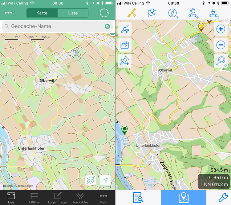
Especially in countryside or wooded areas, where internet reception is often not so good, offline maps are important. And that's where good and easy-to-read(!) map material counts. I have already pointed out in another thread (https://goo.gl/XvSVMW) that I don't like this one and would like to integrate my own maps, but this is another chapter.Back to speed: First of all I have to repeat that Cachly is the preferred geocaching app for me. No doubt about it. Nevertheless, Cachly has to face the competition. And that's why I also downloaded the offline map of Switzerland in Looking4Cache. The maps in L4C renders extremely much faster!! I find practically no delay in zooming or moving! Watch the video here.
I think that's where Cachly should be. Faster and, from my point of view, better readable maps. Logically, the question now is, why are other apps superior in this point? Does Cachly use any (slow) standard framework for map visualization? Isn't there better frameworks for this? It is obviously possible, as L4C shows.
I hope that this wish will find its way into the to-do list and be weighted accordingly. As I said, maps are absolutely important. I'm sure everyone will agree.
-- Dave
PS: Map comparison between Cachly and L4C. Which map is better readable? Decide for yourself.
-
Hello Nic
I am always disappointed with the speed of loading the offline maps. That's why I made two comparison videos:
Video 1 shows the offline map of Switzerland
Video 2 shows the same online OSM mapAs you can see, loading the offline map takes much longer than loading the same online OSM map!
My setup:
- iPhone 6 / 64GB, iOS 11.2.5 connected to WLAN
- Cachly 4.0.1 / Location/Maps: SwitzerlandWhy is the offline map so slow? When you're out in the field, it feels like forever... The main reason for me to use the offline map is that small ways are better visible.
-- Dave
-
Hi Nic
I wanted to ask what the technical reason is that Cachly requires at least iOS10? Are you using frameworks which are not supported by iOS9?
-
It would be different in many ways. Now Cachly loads the logs via API. The simple list can be created without API access (offline). In the list you already have the cache name as it comes from the listing. The list is much more compact. What you can't see on my screenshot is a little search/filter function that let's you find fieldnotes quickly. The grouping by date and the little statistic is a nice but useful feature. When caching with friends, I used this list often to make a screenshot of the caches and then to compare them with my colleagues (sometimes me or someone else forgot to log a cache...).
Above all, I personally just do not see any benefit in reading my own logs. If I need to read one of my logs, then it's a specific one to remind me of the cache again. On your Log-tab I will never ever find a specific log again. I tried to find the log of a cache that I logged only one month ago. It took more than a minute and I could only find it because I still knew the approximate date. No chance to find a log that is six or more months old.
Just to let you know: I do not want to criticize Cachly and your work. It should be a positive input to make the great app even better.
")
- Btwchen and Nic Hubbard
-
 2
2
-
On 25.9.2017 at 0:27 AM, Attila_G said:
Instead of my own logs, I would rather like to see a chronological list of all my logged caches (only cache name & GC code instead of the log text) with a daily summary (count of finds, DNF). Something similar to what Geosphere offers. I would often like to see which caches I logged on a given date. For me this feature would be much more useful.
11 hours ago, Nic Hubbard said:Cachly doesn't save your logs in an internal database, so this isn't something that we have planned.
Ok, let me be more precise. Here is what Geosphere shows:

It's a list of the fieldnotes that I have sent to gc.com via Geosphere. The list shows the 'logged' caches in chronological order separated by date and it shows how many caches I have found or not on that date. When tapping on the text it shows the fieldnote or when tapping on the arrow it shows the cache information.
I don't expect that Cachly does the same. But what would be great is if Cachly would save a similar overview. Jumping to the log or listing would be nice too. No API access is needed for this feature. It's 'only' a database with the sent logs.
Hope this makes it more clearer now.
-
Maybe someone already reported this problem, but I can't find it. There is a very annoying problem in Cachly but I am now sure how to reproduce it. Let my try to explain what happens:
When I am out in the field I search for nearby caches. Then I select one and navigate to them. I look at the map, read the listing, add waypoints and I open other apps like whatsapp, google maps, etc. or I turn off the iPhone when I have to walk a longer distance. Anyway, all the normal things everybody does. I can't tell if I leave Cachly with the open map or when I'm in the listing or somewhere else. After a while I open Cachly again and the selected cache is gone and the map is completely zoomed out. That means I have to zoom in to my position, reload the caches and reselect my target again.As already said: I don't know when this happens exactly. But it happens all the times to me! And it would surprise me if I were the only one with this problem...
(iPhone 6, iOS 9.3.3, Cachly 3.0.3)
-
On 7.2.2017 at 5:23 PM, thebruce0 said:
7. Geosphere doesn't use the exclusive 'Navigate to Cache' method that a number of apps employ - instead you choose a cache item to select as the current 'Target' (overrides the pin colour to red instead of the cache type's). In doing so, it provides a bit more flexibility, such as easily choosing a center point for searches, filtering, listing, distance viewing and whatnot. It also means it's easier to visually spot where your target cache is in relation to other caches nearby, instead of showing a map with only the cache being navigated to.
I miss this "Target" option too. ;-) Would be great to have a switch to "show all caches with the target cache in another color" or "show only the target cache" on the map.
-
I wonder who is using the "Logs" feature to read the own logs? Sorry, but I find this function somehow useless... No cache name, no find function. Why should I read my own logs at all? That's the reason why I ask this question. Who is using this feature and why?
Instead of my own logs, I would rather like to see a chronological list of all my logged caches (only cache name & GC code instead of the log text) with a daily summary (count of finds, DNF). Something similar to what Geosphere offers. I would often like to see which caches I logged on a given date. For me this feature would be much more useful.
- Btwchen and MrGigabyte
-
2
-
On 25.6.2017 at 6:45 AM, Nic Hubbard said:
Open Cycle Maps are just OSM maps with additional layers shown. What in particular are you wanting to show? Can you give me a location example and what is missing in the offline maps?
Hi Nic
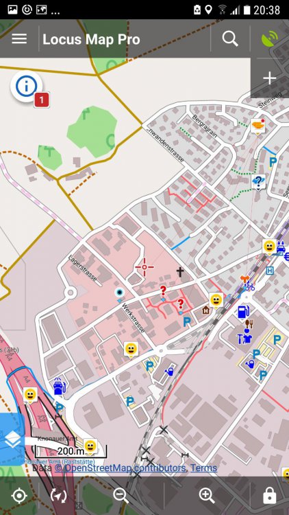
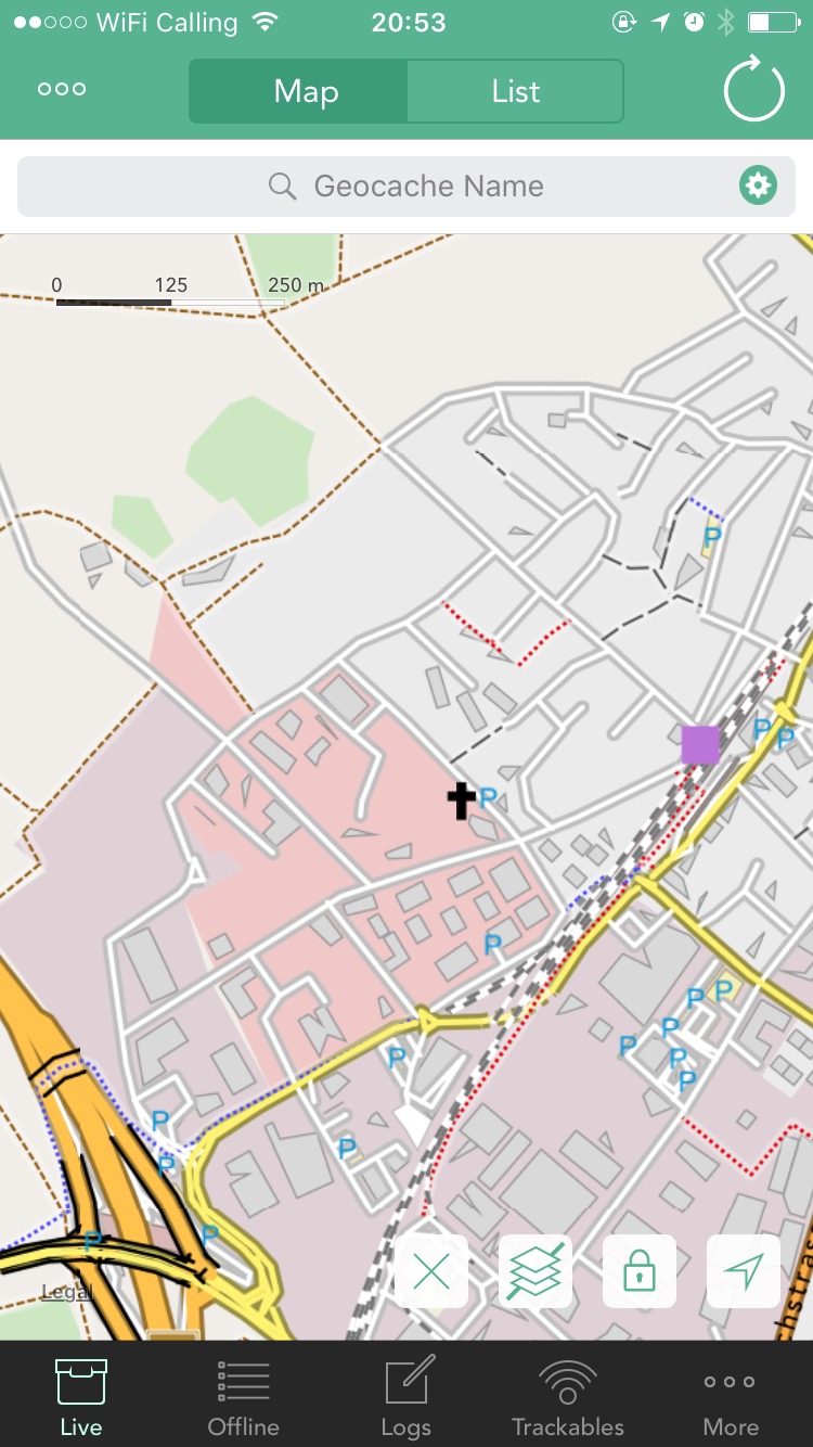
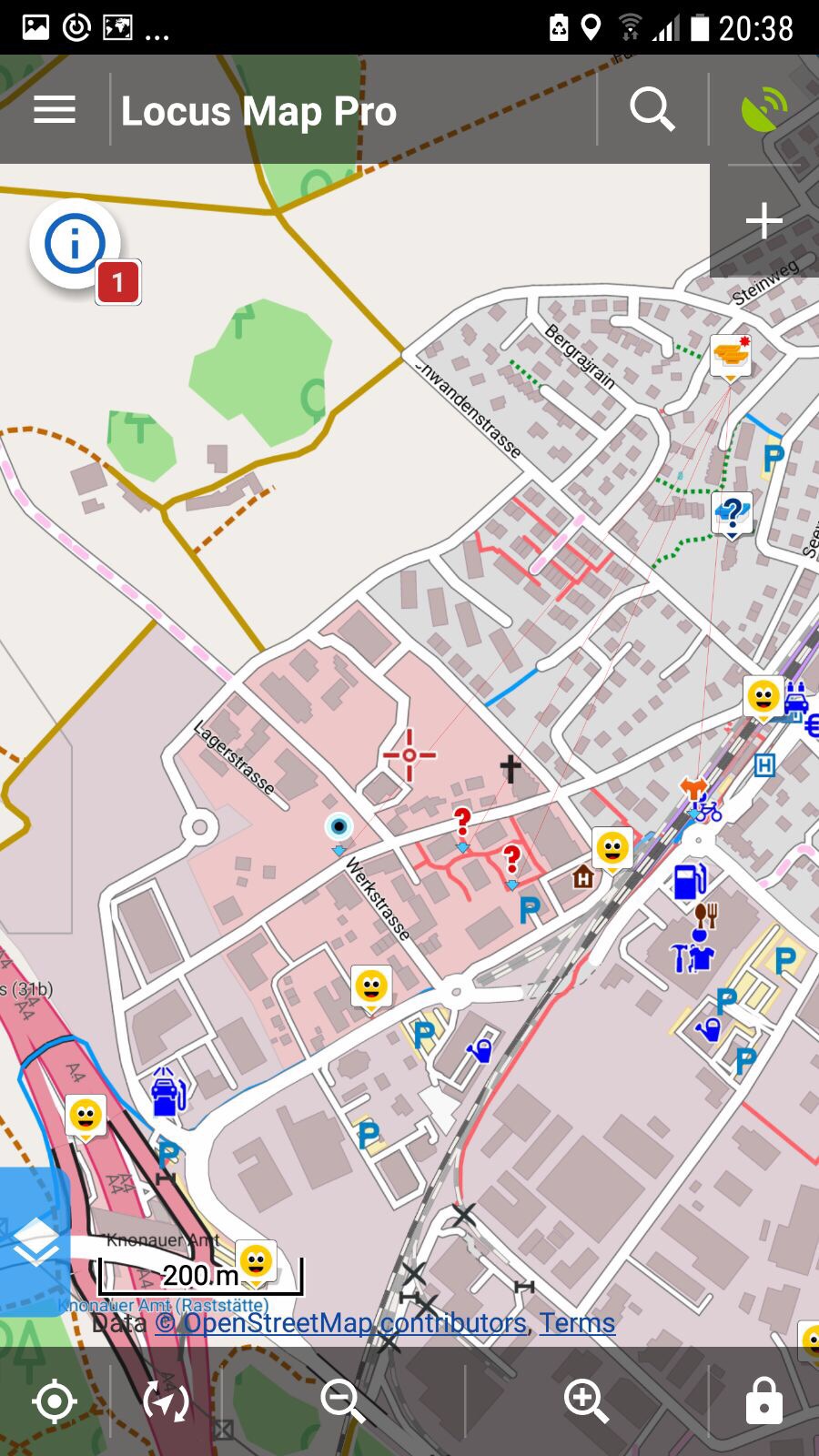
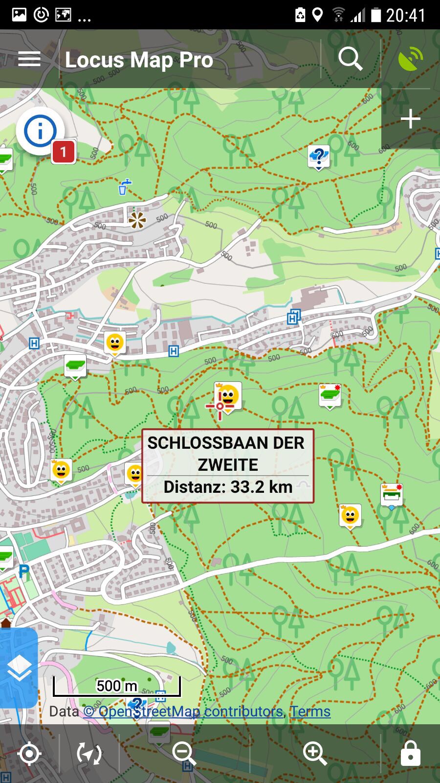
My cacher-buddies uses Locus for Android and the Freizeitkarten-OSM map (german site). These maps are very popular in europe. Often when I search for a route to the cache my friends have a small way or path that is not shown on my offline map. Or they see objects like fountains, huts, fireplaces and much better surface and way patterns!
As far as I know this is mainly affected by the used theme and the 'Freizeitkarten' theme is optimized for geocaching. Maybe you can have a look into this theme. Another great option would be to let the users add their own OSM maps/themes.
Here are two examples (Freizeitkarten on Android and offline maps on Cachly):

-
@Nic Hubbard are you creating the offline maps for Cachly yourself?
-
Ok, sorry I misunderstood this feature. Thanks for clearifying.
-
Cachly only show me 17 friends in the list but I got 45 friends on the geocaching website. Bug?
-
I have some problems with the use of waypoints...
- Why can't user waypoints not be duplicated? (live & offline)
- Why can't cache waypoints not be duplicated in live mode? I get a "request failed: bad request (400)" or an *Error Editing Waypoints ..." error.
- When I try to delete a user waypoint in offline mode, I often get a "request failed: bad request (400)" or a "failed to save waypoint" error. After reloading the cache deleting works again.
-
-
Not every single time but very regulary.
-
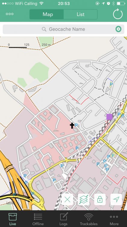
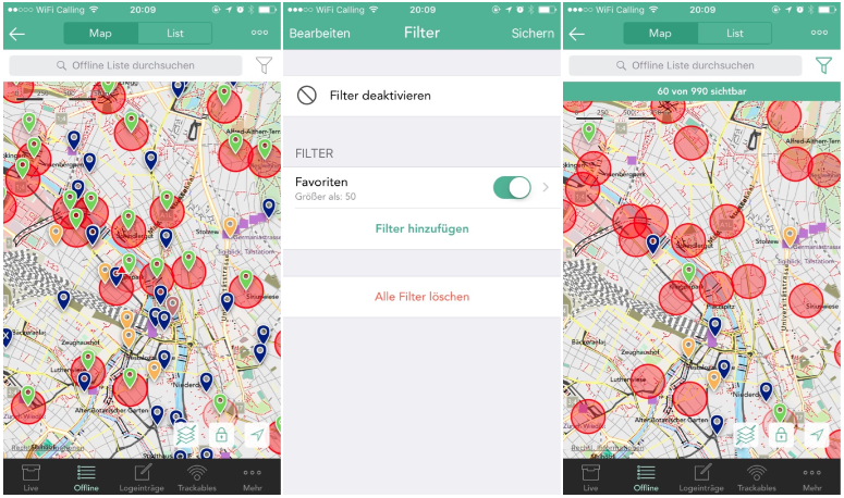
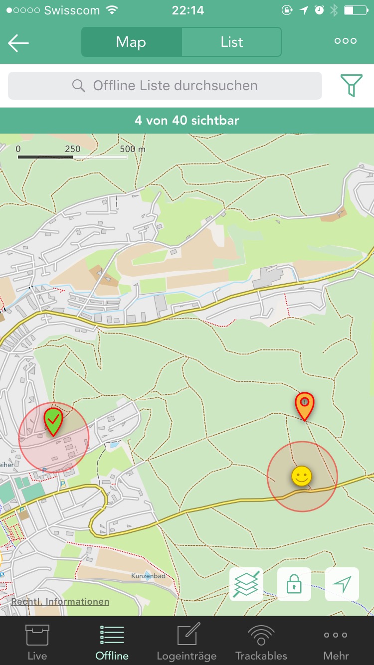
Last week I used Cachly in offline mode. When I used a filter (> 50 favorites), only the desired caches were displayed, but the red radius circles from the hidden caches remained visible on the map. Here are some screenshots:
-
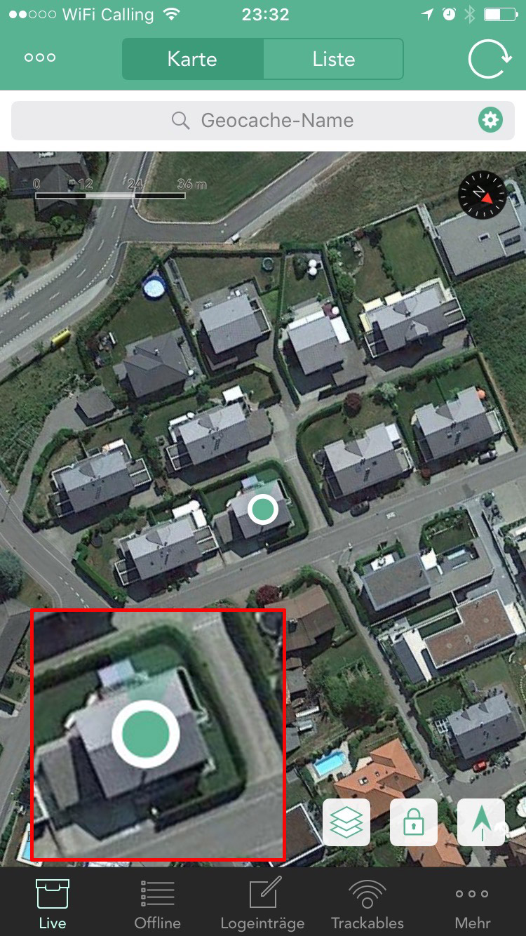
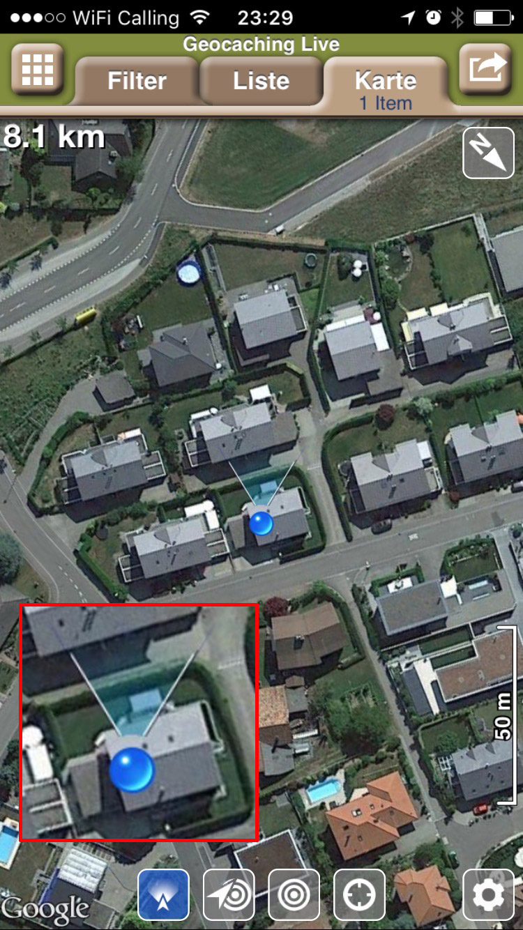
Hello Nic
The icon showing the walking direction is sometimes very hard to recognize, especially on a satellite map. An icon like in Geosphere is much better visible. Maybe you can redesign this?

-
This video shows the problem:
I have not selected a cache as it doesn't matter.
-
Here is a video of this tap & zoom (or slide to zoom) features in Geosphere, MapsMe and CityMaps2Go:
Google Maps in 4.3?
in General Questions
Posted
I don't use Apple maps. The road maps are an absolute disaster in Europe and the satellite maps are also often much worse than those of Google.
Maybe Nic could add a shortcut to simply display the cache / waypoint coordinates on the Google Map App until Cachly 5.0 is ready. Currently you have to copy the coordinates, switch to Google Map App and paste them there again. Troublesome...
If I had known that in advance, I would have stayed with Cachly 4.2.