

Nic Hubbard
-
Posts
3973 -
Joined
-
Last visited
-
Days Won
409
Posts posted by Nic Hubbard
-
-
I think that this solution, as pointed out, doesn't solve the problem in a good way.
Back to the drawing board and working with clustering code...
-
Playing with an alternative to clustering. This loads x number of caches at a time, and tapping a button allows you to load the next x number of caches.
It is really easy to cycle through 7543 caches in about 10 seconds. This also keeps memory low because all pins are never loaded on the map.
Thoughts on this proof of concept?
-
-
3 hours ago, c-ray242 said:
Altough I would prefer the app to store the waypoints on the phone when used offline.
This is the current behavior. Although as others mentioned if it detects a small amount of signal it will try to upload.
When there is no connection it will save the Waypoint offline and then upload that waypoint at a later time (if you return to Cachly later with an internet connection they will be uploaded).
-
5 minutes ago, thebruce0 said:
Yeah red seems 'bad'. Archived is more neutral. I'd Archived should be black, and notes grey. Consistency would imply NM would be red or orange for potential problem, and Owner Maintenance perhaps green, good-to-go.
The original colors in Cachly (besides found and DNF) were based off of the geocaching.com icons. The archive icon is red, so that is where the color was sampled from.
-
3 minutes ago, rragan said:
I like it. What would archived be? Black?
I have not changed it from red yet. Did you think it deserved a different color?
-
Posting this for more discussion. Thoughts?
P.S., this is starting to grow on me...
")
- barefootguru, hidegoseek and ChrisDen
-
 3
3
-
Great idea!
-
5 hours ago, CanUSeeIT said:
I don't know if the Series 2 has a compass, or has to infer direction from movement
The Series 2 doesn't have a compass.

-
Thanks for reporting this. Will get it added to the bug tracker.
-
1 hour ago, ShammyLevva said:
My point exactly rragan. Having small clusters of less than 10 is indeed annoying and easily fixed by having a minimum clustering size.
This for sure is something I will take into account. My plan is to not even show clustering after a certain zoom level. Stay tuned for more details and testing.
-
13 hours ago, ACME WildCachers said:
What would actually happen if a user tries to show the map with clustering disabled if there ere enough caches on the list to otherwise crash the app.
It would crash Cachly.
-
4 minutes ago, rragan said:
Can you make it more fault tolerant so it can deal with a missing comma. Also will it accept d.mmmmm ( decimal degrees) and degrees/ minutes/seconds? This hearkens back to a general coordinate parser.
It currently uses an iOS coordinate parser that, as you have seen, its't very friendly. Implementing the new parser hopefully will be in 2.1.
-
Clustering. This is a touchy subject. I too hate the idea of clustering pins on the map, and I know many do not love that the official app forces clustering of caches.
The reason for this topic. In Cachly 2.1 there have been some major performance improvements. Some users use Cachly in different ways, and some might have 20,000 caches in an Offline List. I have tested 50,000 caches with no performance overhead when loading the Offline List in list view.
However, how does one display 20-50k caches on a map? Currently trying to do this uses so much memory even an iPhone 7 crashes. Putting that many pins on a map just isn't feasible. This is where the idea of clustering come into play.
Here is what I want feedback about for 2.1:
- Offline Lists will use clustering by default if the list has more than 1000 caches.
- Clustering can be turned off for ALL lists with a warning that it might not be possible to show all the caches you want on the map, and it might be very slow.
- Offline Lists will load in List View by default and not even load pins on the map if the user doesn't want to look at it, thus improving performance.
- Other alternatives to clustering? So far, I have not gotten far with this.
-
Can you add a comma between the coordinates and see if that helps?
-
2 hours ago, CanUSeeIT said:
I have no doubt that you could make actually useful.
I do think it would be a lot of fun to build. Working on seeing when we could fit in this development.
-
-
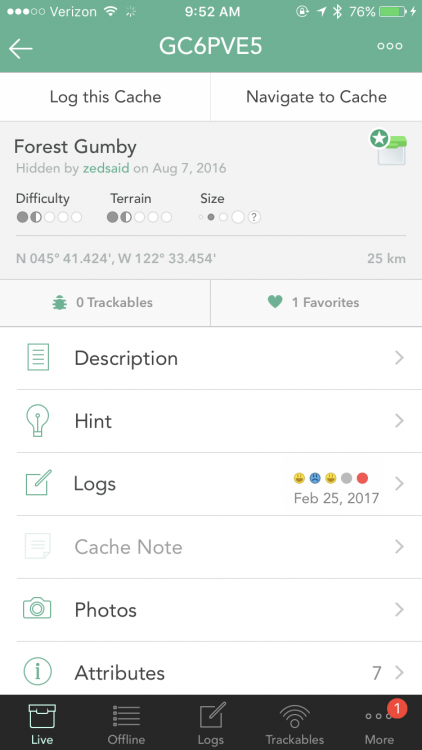
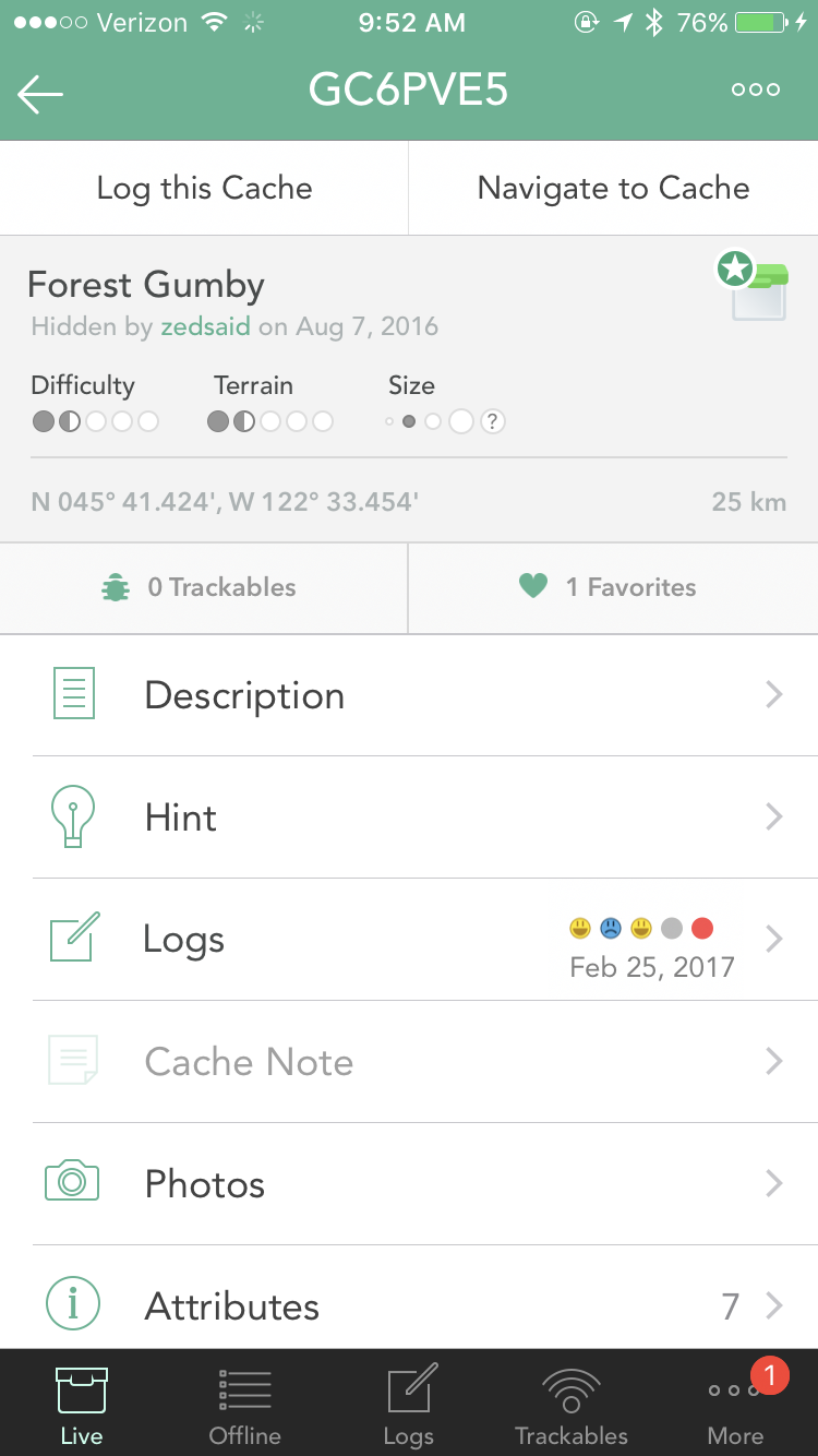
2 hours ago, Rooski22 said:
It's just very hard to read the light grey text on the stark white background.
Are you meaning specifically the Hint, Cache Note and Attributes text since those are lighter grey?
-
Just now, dukeofurl said:
I think groundspeak has gotten around that by making a separate field for just GC codes, and then just auto-filling it those two letters when you click in there.
True. But for the sake of simplicity we use that field for multiple functions.
-
3 hours ago, dukeofurl said:
4) Automatic emails from Groundspeak, links in there, is there a way to make them open cachly instead of the groundspeak app?
Yes, this isn't possible because Groundspeak owns the coord.info domain, which is tied to their app, and only their app.
3 hours ago, dukeofurl said:5) When searching for a cache via the GC number, is there a way to make it automatically think that I'm typing GC in front of the code, even though I'm not?
Since that field takes GC Code, coordinates or a location search there isn't a way to do this.
-
These are two sections that have distinct functionality. Live is for live caches that you load while you have internet connection.
Offline are caches you have saved offline for offline caching when you have no internet connection or just want to save caches as lists.
Let me know if you have any additional questions.
-
Thanks for the suggestion. Are you meaning in Cachly or in the forums here?
-
Finally fix the parsing error in that cache. The problem was an invisible unicode character, 0x1f. Hooray for invisible things.
-
Maybe all users should vote?
Cachly 2.1 and map clustering input needed
in General Questions
Posted
I think regardless of the viewing size, if it is a full country, state or even just a city that the solution I posted proves to be interesting, but not practical. It was fun to build, but as much as I would like to be able to implement a simple solution like this, I can see how it won't work.