

ChrisDen
-
Posts
459 -
Joined
-
Last visited
-
Days Won
28
Posts posted by ChrisDen
-
-
Geocaching HQ sets the requirements that partners have to comply with, especially with regard to the use of data.
I agree this is a bit extreme so I am sure we will see a relaxation in the future.
-
Ok. Ignore that. It is now in km. After a bit of usage it swapped over.
-
Kilometers and meters on the app but miles and feet on the watch
-
Distances in the Apple watch are down in miles. How do you convert to km
-
On 6/7/2018 at 5:41 PM, rragan said:
Sort of a workaround albeit a little tedious. Say you have 3 sat photos on the camera roll for GCXxxx. Select all 3 and Save as PDF in iBooks. iBooks works offline and you can view the images. You likely want you give the iBook entry a useful name like the GC code.
I do not have an option to save to iBooks - is there something i need to set up?
-
I suggest you log out of Cachly and back in again. This might help
-
2 hours ago, rragan said:
Any reason not to pick a default type like Mystery or Virtual to further simplify creation? The user can always change it.
Mystery does not have the 161m circle. Probably better to default to a traditional. Highlighted would make it visible (with a unique colour ;-)
-
With South Africa surrounding two small landlocked countries it would be great if we could have a Southern African offline map.
As a minimum it would have South Africa, Lesotho and Swaziland but a more useful map would include Namibia, Botswana, Mozambique and Zimbabwe.
Is it possible to generate the map to assist you?
-
It seems as if Apple has sorted this one. On the iPhone 7 the heading is all over the place until you hit about 20km per hour and then it points straight forward. Looks like the 7 uses the GPS heading once you get some speed. Does not work on my wife's iPhone 6 so it must be hardware related
-
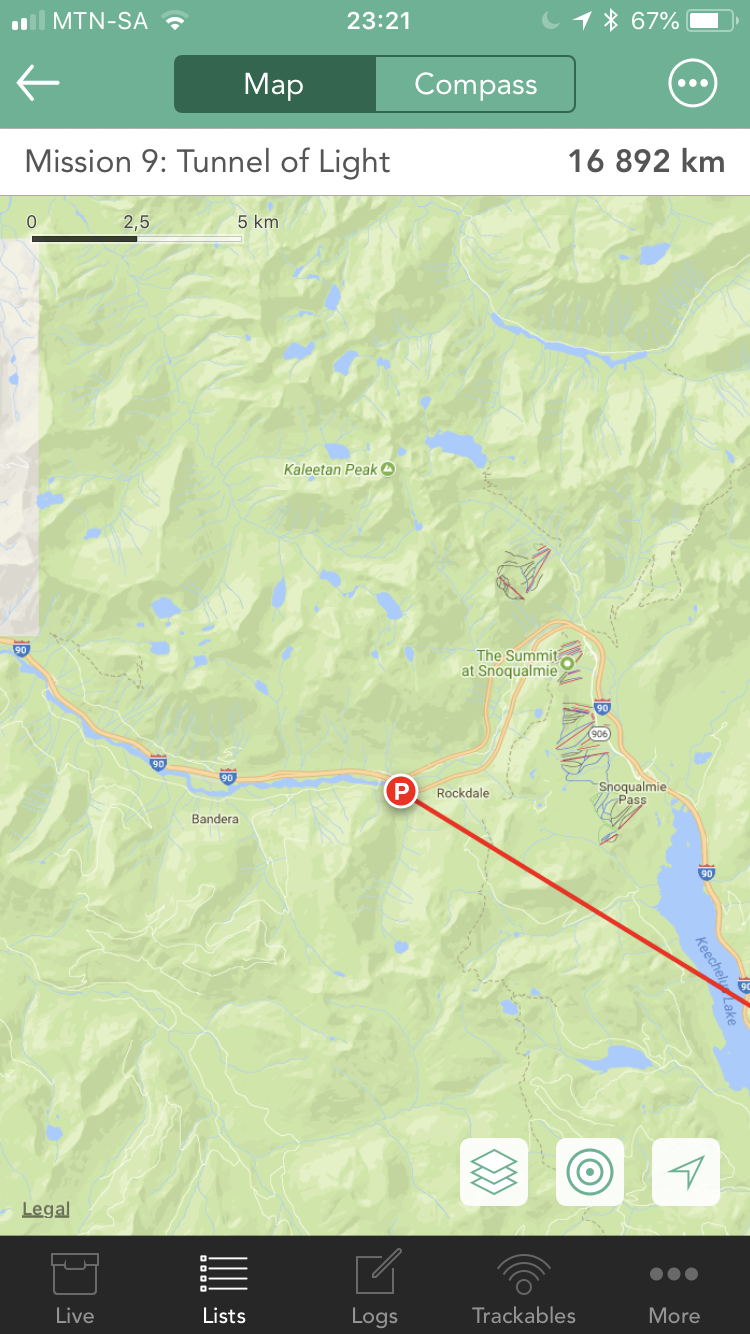
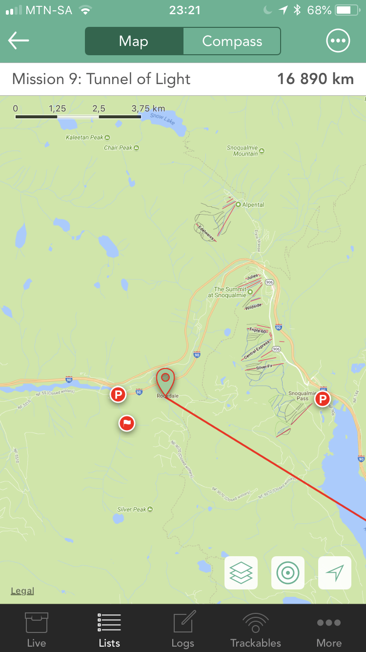
Yes. Go to the cache details screen. Tap waypoints. Tap the parking or trailhead waypoint, not the published coords. Hey screen only shows one waypoint.


-
When you navigate to the published (or corrected) coordinate the other waypoints (eg parking, trailhead, etc) are visible on the map. However, when navigating to any of the other waypoints then only that waypoint is visible on the map. This only happens if you select the other waypoint from the waypoint list. If you are navigating to the published waypoints and then chose one of the others off te map then they all stay visible.
-
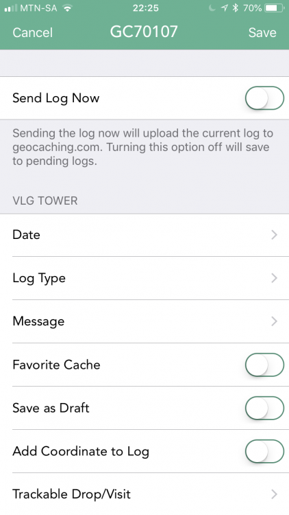
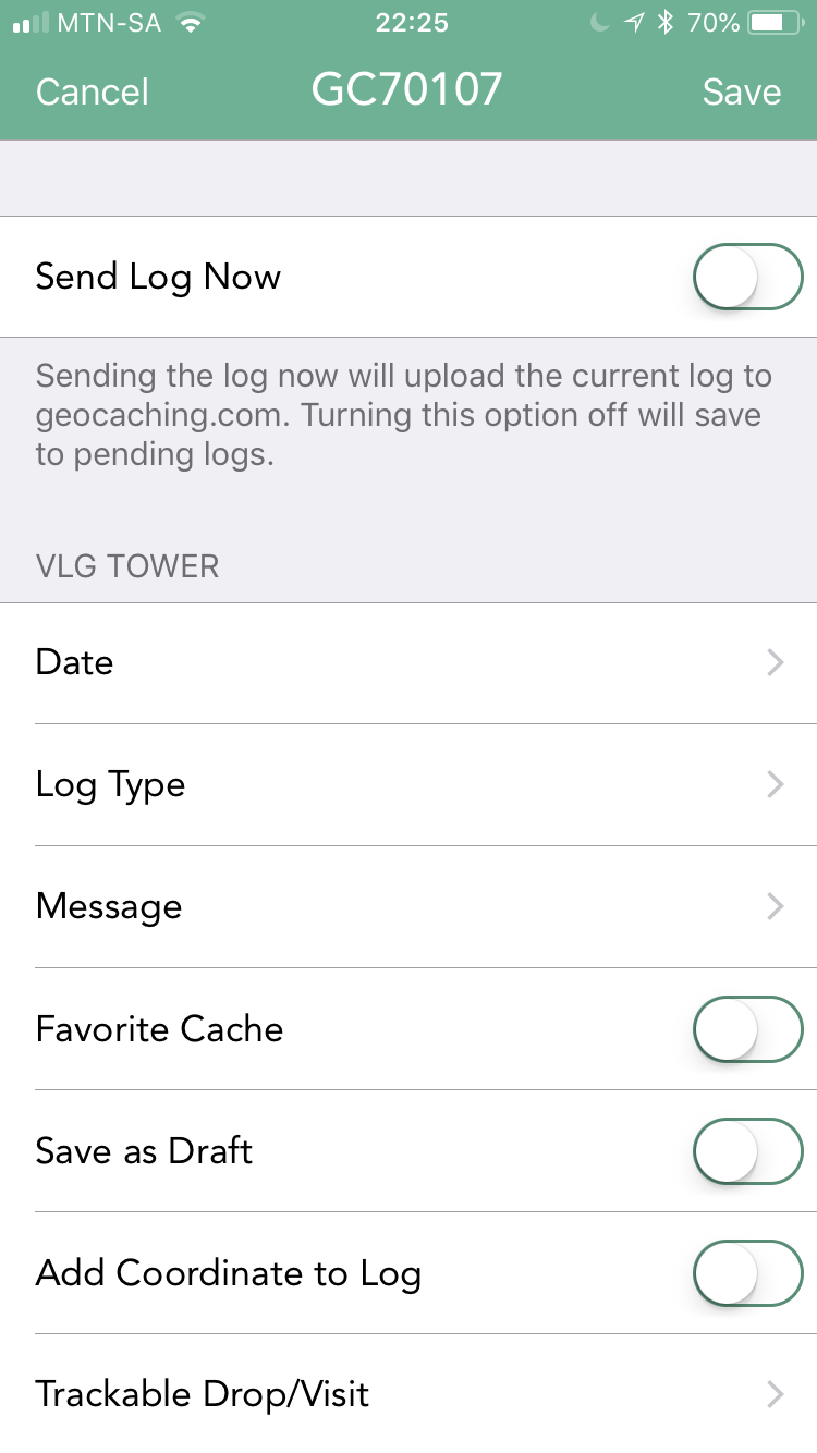
Is it not possible to make a temp fix. If you try to edit that log Cachly crashes. It also appears as if the lack of a date is the issue. Is it not possible to allow for a log with no date at that stage?
-
On 9/28/2017 at 11:48 AM, barefootguru said:
U might be for that reason, L O I S are easily confused with other letters.
p.s. Interesting thread here https://forums.geocaching.com/GC/index.php?/topic/341449-3-million/
I thought they were all excluded to prevent confusion with other characters.
L not in caps with 1, O with zero, U with V, I with 1 and S with 5
All very well explained in this cache description
GC5KW17
-
Not when logging.
-
Just to add some info - all the fields in the pending log are editable except the date. When you tap the date cachly crashes.
-
It would be great to have a progress indicator when you submit a cache log that has a number of the trackable logs (visit or drop).
I was on a trip and had a large number of TBs that wanted to visit places along the route. When you submit a log there is no indication how far it has gone. With the speed issues HQ has been having it would be nice to see an indicator that counts down as the TB logs are submitted
-
When logging a trackable from the cache details screen you can only log one at a time.
Of wood be great if you could visit all or drop all like when logging a cache
-
The only problem I have with the maps are that minor roads have darker colour than major ones.

-
On 4/21/2018 at 2:29 AM, rragan said:
When the keyboard is up, tap the microphone to the left of the space bar and start talking. Note: it thinks "cache" is cash. Geocache as a word works fine.
Aha. I use the SwiftKey keyboard with no microphone. Will have to swap back when caching.
-
Dictation? How do you do that?
-
2 hours ago, rragan said:
It is not common for me but when I did a Power Trail in Yuma, I had a printed checklist for very fast bookkeeping of Found. I later logged the 150+ Finds when I got home.
That could be a reason for logging after the fact. We also did 150 in a day of a spreadsheet but did the logging through GSAK.
Now that I have Cachly I still think a "Log cache" and "Save" while walking to the car will be my next method.
-
If I am not logging on the run then I just create a blank log and save it. Then when I get back to base I can go and edit each log and then submit them.
If you are using Cachly to find the cache it is very easy to tap "log cache" and "save" and then move on to the next cache.
What set of circumstances require you to log using cachly at a later date? Do you record the caches on paper?
-
Offline list and 2 caches
-
We are in a road trip. Did our logs as went and saved them. Tonight I did the minor edits and sent them one at a time. The last one crashed when I tried to edit it. The date field is blank as is the log type. Both of those would have been completed before saving. The message field was blank as I did not add any message.
It was the last log of the day.
I had to delete it and log agsin.

Where is log texts
in General Questions
Posted
If you save the logs rather than sending them immediately you can export you're logs and then submit them