

Nic Hubbard
-
Posts
3971 -
Joined
-
Last visited
-
Days Won
409
Posts posted by Nic Hubbard
-
-
Just now, barefootguru said:
Happy to, thanks for investigating!
Can you email support@cach.ly please.
-
50 minutes ago, barefootguru said:
Since a very early version. Is there a fix I can make, or do I have to reinstall?
I would like to be able to take a look inside of the offline maps folder, but there is no way to do that without building in extra code and having you install a beta version. Would you be willing to install a beta?
-
Yes, this is not normal. How long have you had Cachly installed?
-
19 hours ago, forest-ghost said:
Yes I was able to see the topo contours for Jeff city. I guess the map for St. Louis doesn’t have as much shading. All the big parks in my area are devoid of topo lines.
Do those areas have elevation change? If so, they should show topo lines.
-
Creating a backup inside the app is just for GPX files. The docs describe how to backup the database.
Did you backup the database file? Was there a specific reason why you deleted Cachly?
-
That is correct, if the maps are geographically far apart then you will see overlapping map elements, especially ocean features.
-
On 4/13/2024 at 12:45 PM, Geoboater said:
Along a similar vein....
I used to be able to toggle between text & HTML for displaying the hint, but I can no longer find where that opiton resides in 8.0.
Example: "Look low [br] fake bolt" ; would like to see "look low" and "fake bolt" on separate lines (as they show on Geocaching app.)
Hints do not allow HTML. Do you have a GC code for the cache in question?
-
Hi @BassXX. I am sorry that you feel cheated about the new subscription model. As others said, it was done out of necessity because Cachly was losing money on the great cost of offline maps and the pay once model was not paying for the infrastructure costs.
Shoot me off an email at support@cach.ly and we will make it right. Hope you have a good day.
-
Hi Dave, shoot me off an email to support@cach.ly and we will get this worked out.
-
Access any Pro feature and it will show the dialog. Go to More > Counties and it will show the subscription dialog. Hope this helps.
-
Please update to 8.0.1 as this has the bug fixes.
-
On 4/8/2024 at 2:39 PM, VIP Tom said:
N 051° 54.232' E 000° 47.934'
Thanks. Investigating.
-
What are the coordinates here? These might be tagged as a different trail type in Open Street Maps. Trails and paths do show in Cachly a low zoom, so that is why I want to check these specifically.
-
When was your map file download?
-
32 minutes ago, Darkwing_Duck said:
That´s all??? Sounds easy ;-)
Have I to import that "Draft" at geocaching.com at "field notes table" or does work automatically?
I don't use the old Field Notes dialog on geocaching.com, but the new Drafts. But yes, once you submit the log and use the Drafts option it will show up on geocaching.com.
-
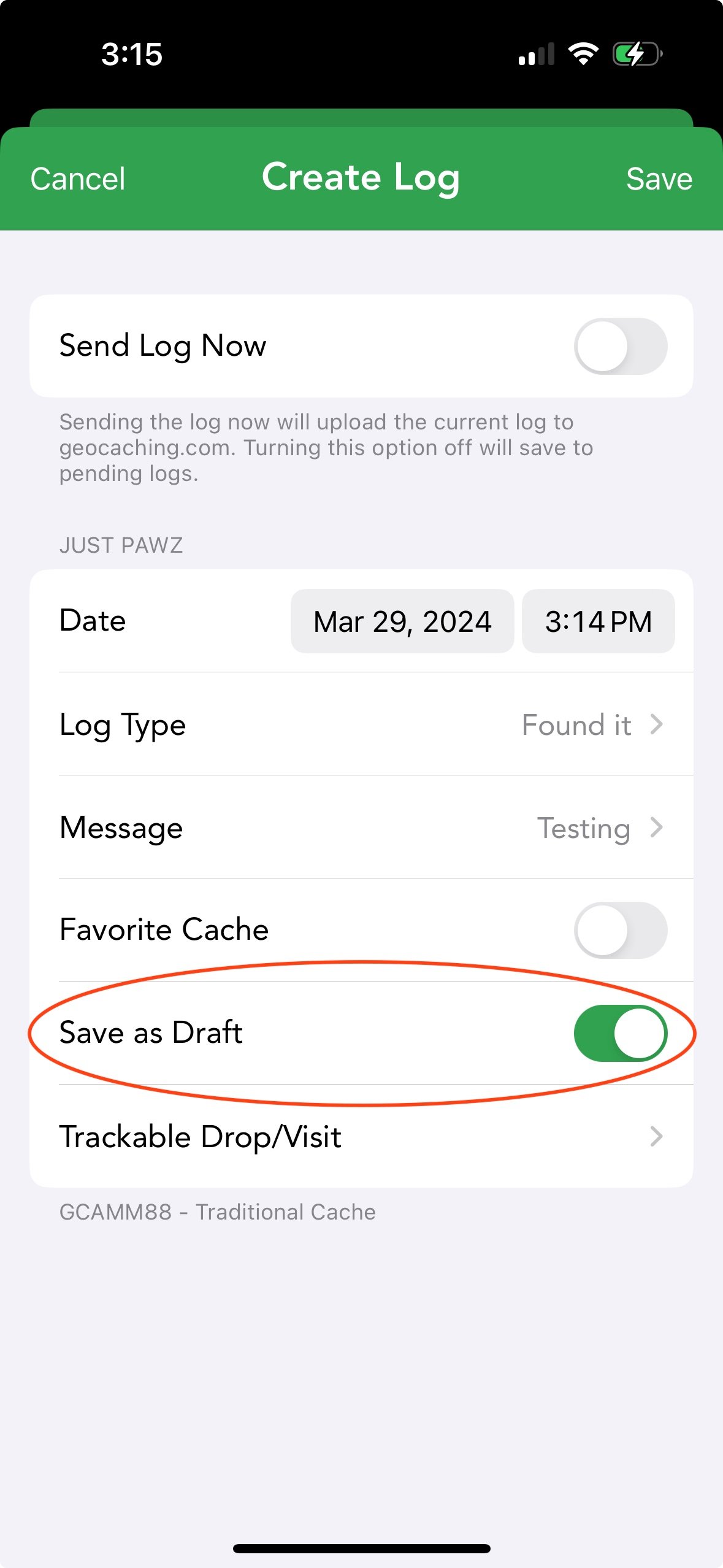
In Cachly you would use the "Save as Draft" when creating a log in Cachly. Draft is the new name for Fiend Notes.
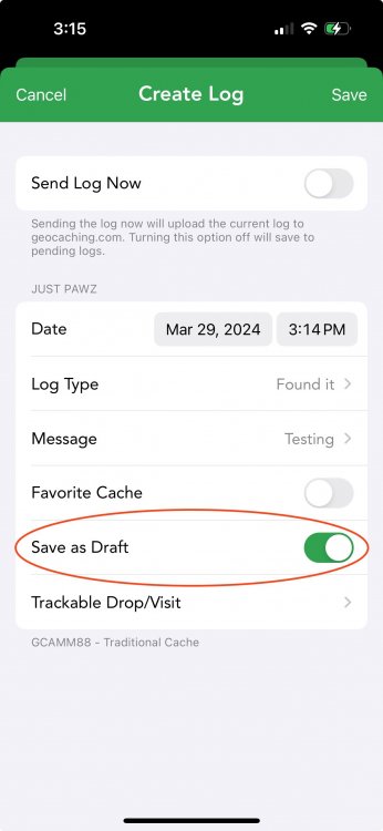
Hope this helps!
-
Are you meaning how do you create a Draft/Field Note in Cachly?
-
6 hours ago, barefootguru said:
Hmm, it downloads fine from the website, so I guess that's my workaround.
The website just downloads a .zip file. Cachly downloads full cache data.
In 8.0 downloading the .zip will be an option.
-
-
6 hours ago, ivans said:
Am I understanding correctly that the “Update Caches / .. / Full Cache Data” command means full cache data excluding images?
Full cache data means it will include image data from 30 images from each geocache. Image data means the image comment and the URL of the image. It does not mean it is downloading the image. That is why there is an additional Download Images option.
The reason this is separate is that if a user updated an offline list with 1000 caches, it is possible there could be 5,000-10,000 photos, which is huge.
-
For Live searching this isn't possible as the geocaching.com API does not support this.
For offline lists, we do have this feature! When adding an attribute filter just tap the attribute again to change it to a "not" filter.
Hope this helps.
-
The issue here is likely that once the file downloaded Cachly was running in the background and it was trying to uncompress the map file. Because that takes longer, iOS killed Cachly.
If you are able to redownload and leave Cachly open that would be the only way at this point to solve the issue and allow the map to fully install.
-
I will take a look. Thanks.
-
3 hours ago, ivans said:
Anyway, I do not understand why images in Cachly are replaced by placeholders during update cache with full data.
I am not seeing any images being replaced when you do a full data update. Cachly adds additional photos that are grey and then you need to download the image files.

Cachly using massive amount of storage since upgrading
in Support
Posted
You can just delete the Antartica map and that will free up your space.
The reason you are seeing it is that in the past, you must have download Antartica and it failed to uncompress (likely because the download was in the background) and was hidden in your filesystem. Cachly 8.0 will uncompress these and place these in your maps folder so that you have the option to remove them or leave them.
Let me know if deleting it clears up space for you.