Chris
-
Posts
14 -
Joined
-
Last visited
-
Days Won
2
Chris's Achievements
")
Newbie (1/14)
4
Reputation
-
 Nic Hubbard reacted to an answer to a question:
Back arrow at bottom of screen
Nic Hubbard reacted to an answer to a question:
Back arrow at bottom of screen
-
Hi Nick, Well I do now!!! Had one for years and never thought of using it with Cachly. Amazing, so pleased I asked and thank you. chris
-
Hi, With iPhones getting bigger and bigger I was wondering if there might be merit in having the option of the back arrow at the base of the screen. Almost everything can be done one handed but the back arrow top left is a helluva stretch for even the longest thumb! It seems it’s one of the most used commands yet it’s the hardest to get to if, like me, you’ve often got only one hand free. Thanks.
-
Nic Hubbard reacted to an answer to a question:
New mark on map icon when note written
-
Thanks Nic, thats very helpful. If it’s not possible to have it in map view, then log filtering is the next best thing. Appreciate your help.
-
Just trying this out and it seems to pick up and display the icon wherever you have written in the personal note section rather than if you have written a note on the physical log. So whilst helpful it’s not telling me if the log has a note written by myself only that I have a personal note in the cache page. I guess from now on I could write the word ‘signed on’ or ‘unsigned’ first in the personal note section which would at least stop me having to scroll through all logs. Still have to open the cache to find out though rather than know at a glance at the map pin or list view.
-
Thanks Nic, Thats really helpful, I wasn’t aware of that on the expended pin, and although not quite what I’d imagined, at least saves having to open the pin fully and scroll through logs, thanks.
-
Hi, I really enjoy challenge caches and highlight those I qualify for but have not yet signed. However, there are some that, although I don’t yet qualify, I have visited and signed (write note) instead of find logged and thought it would be great if a symbol appeared on those a bit like the corrected coordinates red triangle. I’d noticed that when using the map of challenge caches on Project G-C a small white note was displayed on those I’d signed and have found it really useful.
-
Nic Hubbard reacted to a post in a topic:
New offline map issues
-
Hi Nic, just updated to 2.01 and have seen the map changes. Thank you very much for sorting this, it'll make a massive difference to using the app offline whilst out and about. In my opinion the app was second to none before version 2, now it's streets ahead of the competition, fantastic job.
-
Nic Hubbard reacted to a post in a topic:
New offline map issues
-
Hi Nic, That looks so much better, although presented slightly differently it has all the necessary detail. If that were available offline it would be so much more user friendly at those levels of zoom. Can't fault the customer support, thanks again for all your hard work.
-
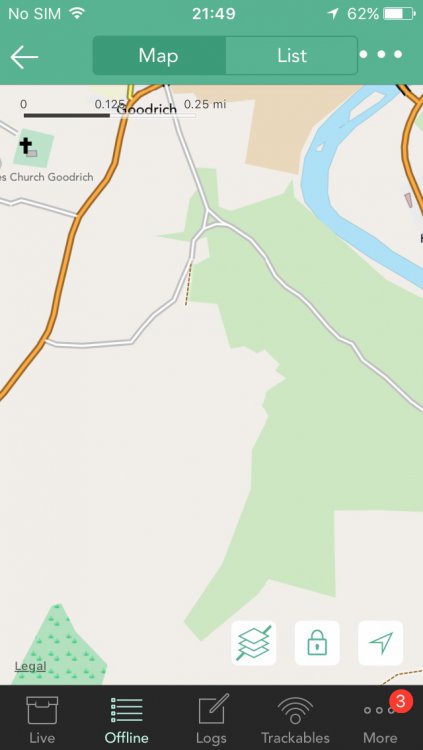
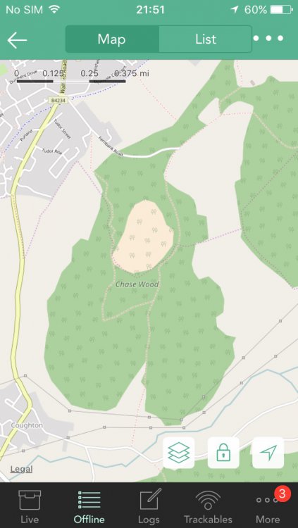
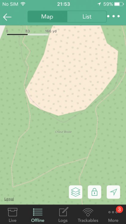
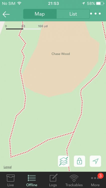
Hi, Here are the coordinates for a cache smack bang in the middle of the pictures. There is a series that surround it following the footpaths (more or less) should you need any more. Hope that helps. N 051 53.816 W 002 34.834
-
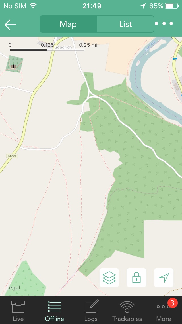
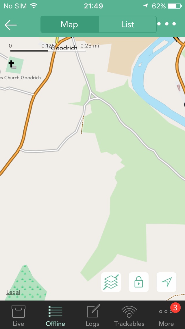
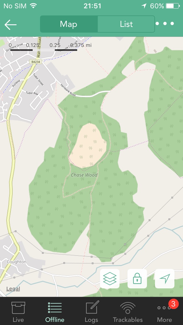
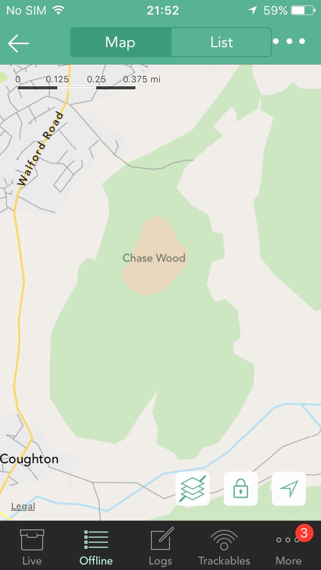
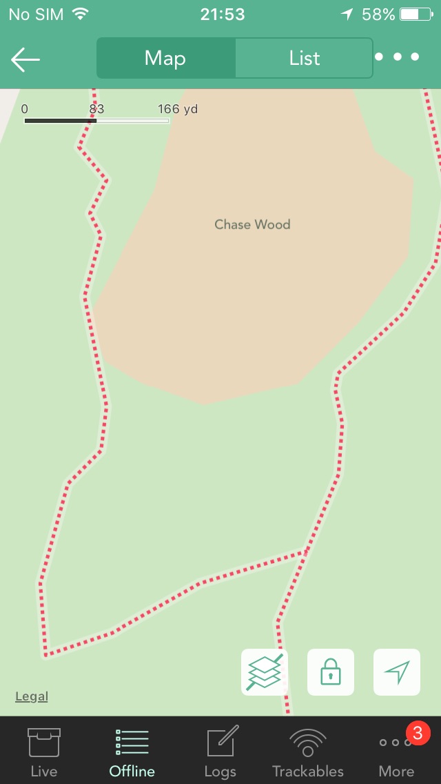
Hi Nic and thanks for the swift reply. Hopefully the attached pictures will explain what I mean, two different areas with the same results. The rendering on the newer maps is slow mostly when at high zoom (which unfortunately is what I'm having to use) although it is also happening at lower zoom levels too but seems to correct itself quicker. I'm guessing it's a trade off between having a large map but keeping the space required for it as low as possible therefore some detail is being lost? Hope it all makes sense.


-
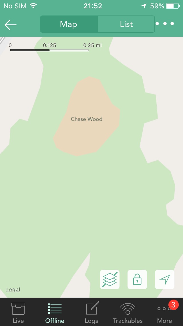
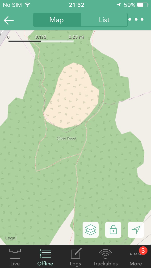
Hi Nic, I have been trying out the latest update over the past couple of days and have been very pleased with all the new features, you've done a fantastic job making a great app even better! I have however run into a couple of issues and wondered if you could help. The new offline maps for the Uk are different to what was being used before (I think it was Openstreet?) it's a great facility to have the whole uk downloaded onto the phone and whilst they carry some useful extra information, especially showing trig points, it's posed a few problems whilst out in the field, for me at least. (Using an iPhone 5s, no sim, just GPS) What I've noticed is that the offline mapping used before showed footpaths in detail without having to zoom right in, it's been particularly useful in the forests/woods when planning where to go next and getting an idea of what is available to walk over when in a large wooded area for instance. I've found that the new maps only show these footpaths when you're really zoomed in which makes planning that move much more difficult, you lose a sense of where you need to head as the area is so small and you revert to endless scrolling. Having to do this and zooming right in has also caused quite a lot of void spaces to appear and it is taking an age to download that particular tile. Before it was instant and most of the time you didn't have to zoom in so much to get the detail up. Is there a way to have Openstreet as the default offline map or am I stuck using the whole of Uk map and having to zoom right in to bring up the detail required? Perhaps I have missed something but have tried all I can think of with no luck. Other than this one thing which unfortunately is proving to be a massive user friendly issue the rest of the update is great. Thanks.
-
Thanks Nic, that's really helpful, didn't see it (or try it tbh). One by one it is then
-
So far I haven't been able to find a way of refreshing an offline list. I'm just wondering if this is possible at present or if it is something that could be added in the future. For instance, if I do a search for a particular CO and download all their caches for offline use and tick a few off the list when out and about, would it be possible to just refresh that list when I'm back online and after I have logged them through the official site. At present I'm having to rely on a tick in the paddle (providing I 'log this cache' but don't send) rather than a refresh to show its been logged. At present I'm having to download the list all over again to get the updated information. A simple refresh of an existing offline list could be really helpful.
-
Really enjoying using the app just a couple of ideas if I may. On the pop up, I think it may have been mentioned already, distance to cache. Perhaps size, difficulty and terrain pips in a nice bright colour rather than grey as they are fairly small. Rather than start a new topic could I just add that when selecting 'navigate to cache' all other caches in the area the map is currently showing disappear. Would be useful to have them still visible should you want to do a quick detour on route.