Search the Community
Showing results for tags 'export'.
-
I'm exporting about 2000 caches from a region in the Netherlands and noticed that my Garmin GPS62s only picks up a fraction of the caches. I tried to import the exported GPX in geosphere where I encounter an error. The error message says there are control characters in the description. The cache that had control characters (GC4C3D8) indeed had a ^X and a ^Y in the description. Exporting the GPX file from the geocaching.com website didn't produce the ^X and ^Y characters. After I removed the control characters from that cache, the ones in the same series and another cache (that had ^B among other characters), all 2000 caches loaded fine in my Garmin and in Geosphere. Could the export option automatically filter out possibly offending characters?
-
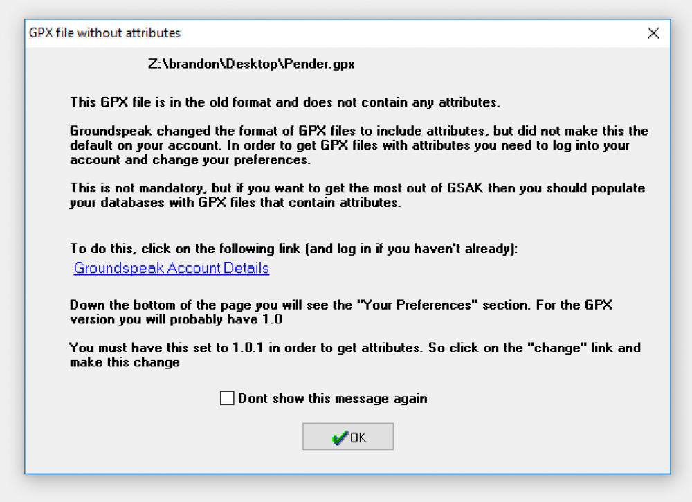
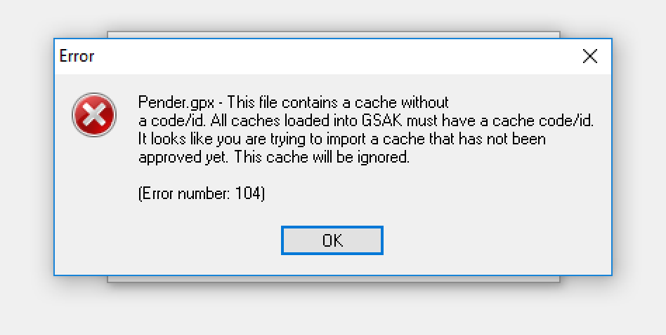
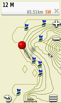
I'm running into a couple of issues when exporting an offline list from Cachly v3.0.2 (4) and importing into GSAK and directly onto my GPSr. First off, I get this GSAK warning dialog (see attached image) that says the GPX file is in an old format and does not contain any attributes. Second, I get a ton of errors saying (see attached image): The GPX file exported from Cachly appears to contain attributes, but also contains a bunch of empty <wpt> tags, one for every cache. For example: <wpt lat="48.824467" lon="-123.279915"> <time>2005-04-08T17:00:00-07:00</time> <name>GCNDQ2</name> <desc>Baby Back Ribs by land-air-sea, Traditional Cache (1.5/1.0)</desc> <url>http://coord.info/GCNDQ2</url> <urlname>Baby Back Ribs</urlname> <sym>Geocache</sym> <type>Geocache|Traditional Cache</type> <gsak:wptExtension xmlns:gsak="http://www.gsak.net/xmlv1/5"> <gsak:Code>GCNDQ2</gsak:Code> <gsak:IsPremium>false</gsak:IsPremium> <gsak:FavPoints>2</gsak:FavPoints> <gsak:UserFlag>false</gsak:UserFlag> </gsak:wptExtension> <groundspeak:cache xmlns:groundspeak="http://www.groundspeak.com/cache/1/0" id="227699" available="True" archived="False"> <groundspeak:name>Baby Back Ribs</groundspeak:name> <groundspeak:placed_by>land-air-sea</groundspeak:placed_by> <groundspeak:owner id="52101">land-air-sea</groundspeak:owner> <groundspeak:type>Traditional Cache</groundspeak:type> <groundspeak:container>Small</groundspeak:container> <groundspeak:attributes> <groundspeak:attribute id="1" inc="1">Dogs</groundspeak:attribute> <groundspeak:attribute id="7" inc="1">Takes less than an hour</groundspeak:attribute> <groundspeak:attribute id="6" inc="1">Recommended for kids</groundspeak:attribute> <groundspeak:attribute id="13" inc="1">Available at all times</groundspeak:attribute> <groundspeak:attribute id="15" inc="1">Available during winter</groundspeak:attribute> <groundspeak:attribute id="32" inc="1">Bicycles</groundspeak:attribute> </groundspeak:attributes> <groundspeak:difficulty>1.5</groundspeak:difficulty> <groundspeak:terrain>1.0</groundspeak:terrain> <groundspeak:country>Canada</groundspeak:country> <groundspeak:state>British Columbia</groundspeak:state> <groundspeak:short_description html="False">Nice log strewn beach to explore at lower tides.</groundspeak:short_description> <groundspeak:long_description html="False">This is a small bay to explore via boat or on foot. Easy access. The cache contains typical cache items!</groundspeak:long_description> <groundspeak:encoded_hints>At Piggot bay launch look at the large hollow log behind the beach sign that has mayne carved into it. Look inside the hollow log. Make sure the cache is covered and univiting to explore by muggles.</groundspeak:encoded_hints> <groundspeak:logs> [REDACTED] </groundspeak:logs> </groundspeak:cache> </wpt> <wpt lat="48.824467" lon="-123.279915"> </wpt> <wpt lat="48.775665" lon="-123.201019"> <time>2008-03-16T17:00:00-07:00</time> <name>GC1ABQQ</name> <desc>Captain Saturna - stumped! by jackson@friends, Traditional Cache (1.5/1.5)</desc> This would also explain why when I export and load a GPX file from Cachly directly onto my GPSr, I get waypoints on top of every cache displayed. This occasionally makes is difficult to actually select a geocache from the map view on my Oregon 450, as the waypoint is often selected first. After multiple attempts, I can usually get the cache selected. Not a show stopper, but annoying none the less.
-
I had 4 pending logs saved on Cachly all of them using the find count and cache owner name keywords. When I export my logs to a .txt file, the keywords changed to regular text. The cache owner names were correct for each cache but the find count keywords all showed the same number.
-
I'm a long time user of GSAK and the iGeoKnife iPhone app (before Apple discontinued the app). Since then, I have sorely missed an awesome feature that allowed me to export unsent cache logs to a TXT file. This TXT file could then be emailed from the app as an attachment and then imported into GSAK. This was a simple TXT file that basically contained the GC Code, Log Type, Date/Time stamp, and the cache log text/message. It was a comma separated TXT, which I'm sure I could get the exact file layout if needed. The file is then imported into GSAK to create multiple cache logs that could be uploaded/published to geocaching.com all at once. It was a great feature for logging offline lists en masse, logging a power trail, or logs for caches when there is no good cell service. iGeoKnife had a log setup option where I could enter and save my email and then create/send the file, or delete/reset the existing log so you can start over. The TXT file would then be an email attachment (or you could copy/move it over to your pc when the phone was hooked up to iTunes) I thought that the TXT could be populated using the cache log information in Cachly when the Send Log Now switch is off and the log not sent. Under the More Tab, you could have the TXT Log file setup as an option there where users could enter their email address and save, create the file based on the condition above, or reset/delete the existing TXT file and a new, empty one created. Unless reset, the existing TXT log would simply append itself with any new cache logs that have not yet been sent from the app. I think that this would be an awesome feature that would replace the iGeoKnife app that is no longer available, and reconnect current GSAK users back with a compatible iPhone app. --Razz007


