

forest-ghost
-
Posts
15 -
Joined
-
Last visited
Posts posted by forest-ghost
-
-
That would be really awesome. The coords for Rockwoods Reservation are N 38° 34.002 W 090° 40.233
-
3 hours ago, Nic Hubbard said:
Creating a backup inside the app is just for GPX files. The docs describe how to backup the database.
Did you backup the database file? Was there a specific reason why you deleted Cachly?
I was able to figure out how to add the lists back in one at a time. So will be more careful about using iTunes in the future. I did not back up the database through iTunes because I thought I was backing up the data base through the app because the message says “create backup.”
I find this label confusing. It would be nice maybe to have a note or something detailing that the backup is only for .gpx files. Or did I miss that?
I deleted cachly because whenever there is a big update to an app, I find sometimes not all features load properly unless the app is removed and re-installed. I was trying to see if my other issue with the topo maps was related to this.As a side note, I just want to say thank you for all the updates and for the fantastic app. I absolutely love cachly and hope I didn’t come off as too grumpy in my post. I pretty much exclusively stick with the iPhone because I don’t want to use any other geocaching app.
-
3 hours ago, Nic Hubbard said:
Do those areas have elevation change? If so, they should show topo lines.
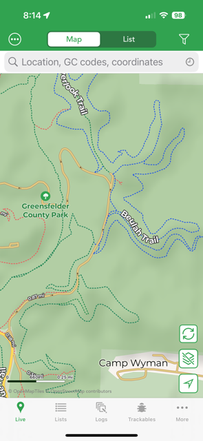
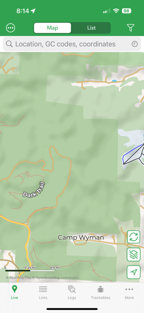
Yes there are some pretty big hills in that park. There are a bunch of really hilly areas that don’t show any topo lines. For reference: Rockwoods Reservation, Greensfelder County Park, Babler State Park, Weldon Spring to name a few.
-
Thank you for looking at the problem for me. I really appreciate your help.
-
18 minutes ago, Team DEMP said:
You can't delete the active map. You need to make a different offline map active or an online map such as Google or Apple and then you should be able to delete any offline map.
Okay that fixes it thank you.
-
15 minutes ago, Team DEMP said:
I download MO maps and I see the topo/contours in various places such as just south of Jefferson City. If you go to this and zoom in so you see what I show below?
I wasn't clear if you also downloaded Washington State and you see the elevations there and just not in your Missouri download?
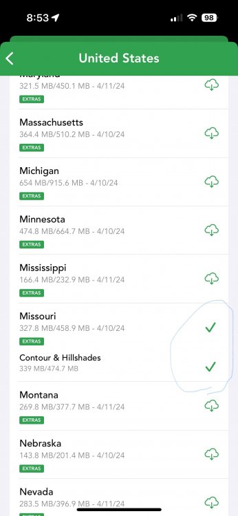
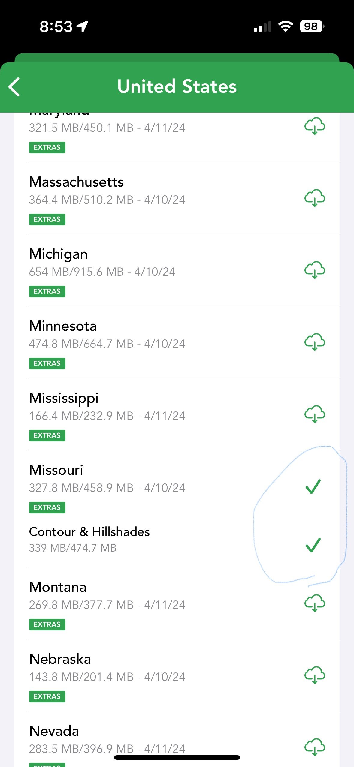
Yes I was able to see the topo contours for Jeff city. I guess the map for St. Louis doesn’t have as much shading. All the big parks in my area are devoid of topo lines.
-
Also, when I went to delete the individual state map for MissourI I was unable to do so.
I can delete the contours but not the state map.
-
Yes that was the first thing I checked.
-
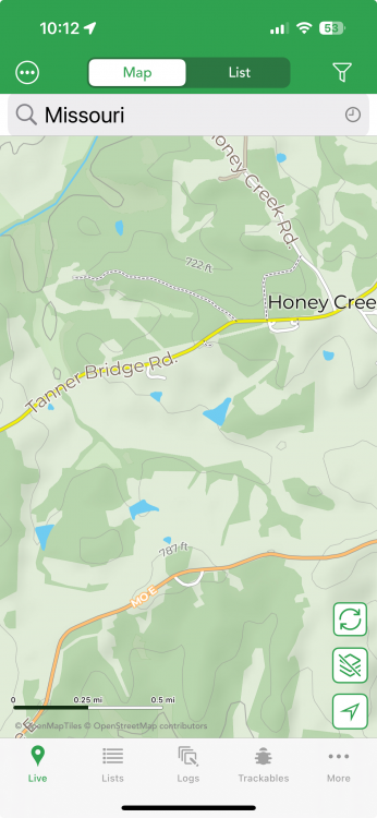
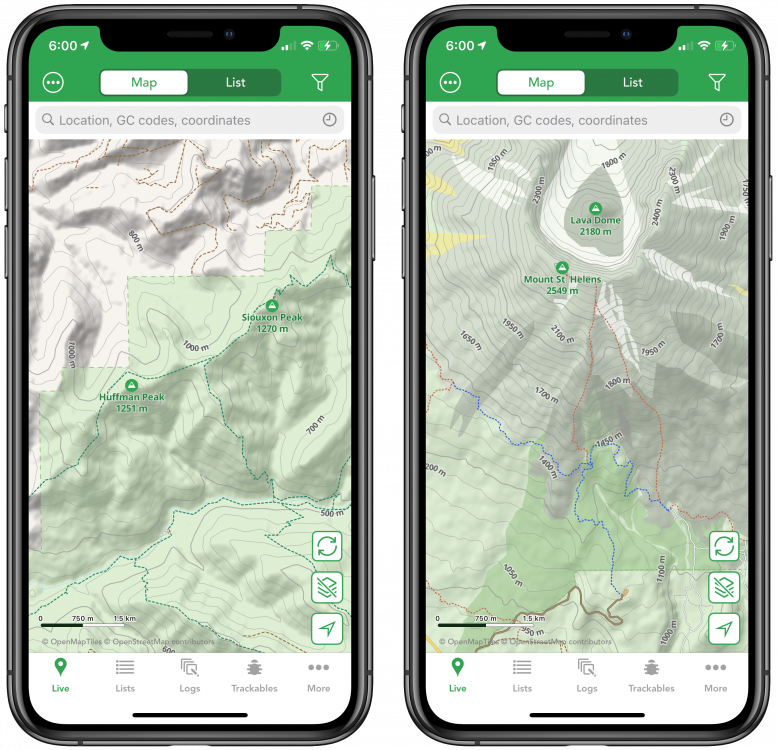
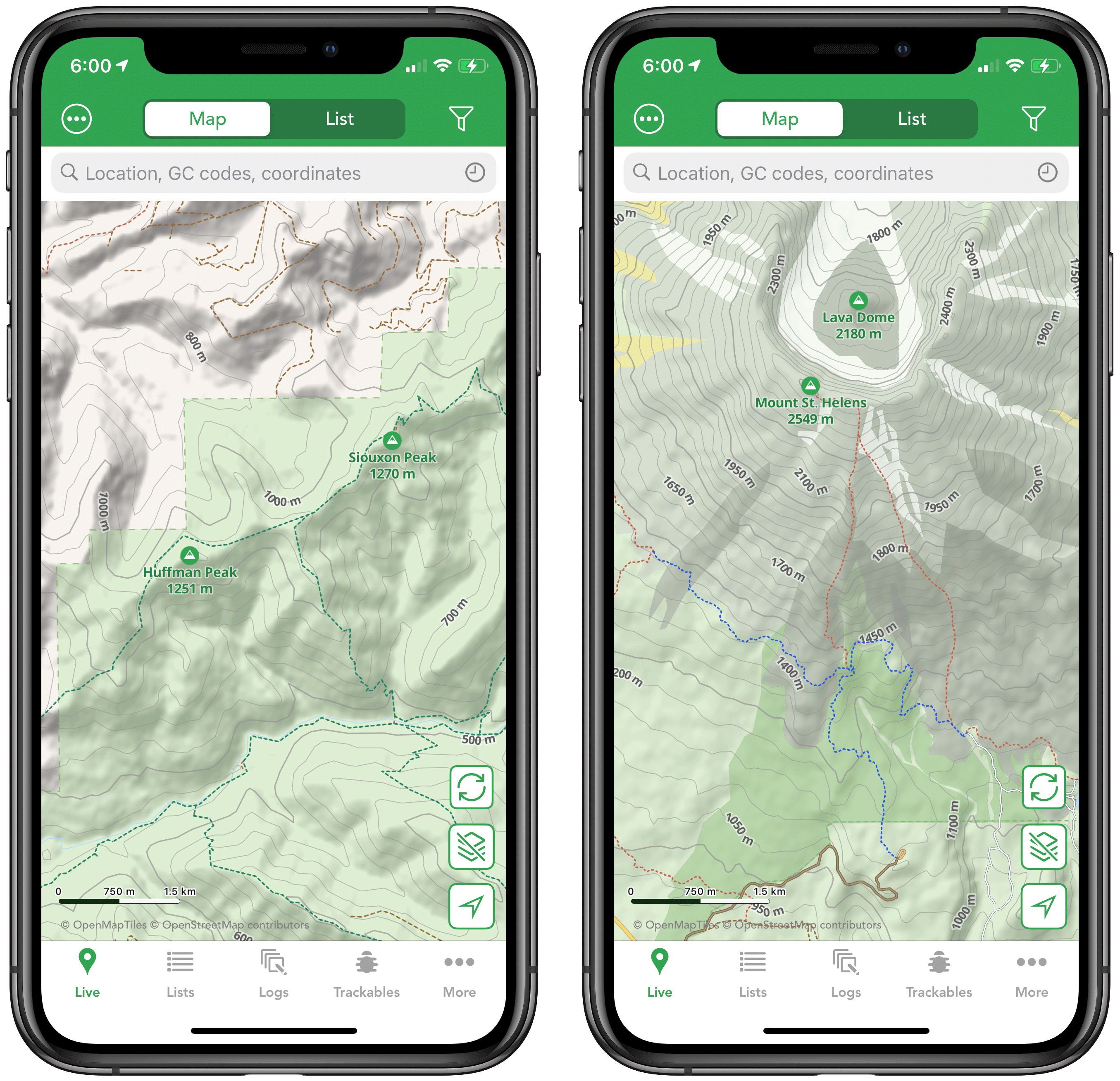
Here are images of the pro maps for my local area in a park with lots of elevation changes and hills.
-
I noticed when I upgraded to the pro offline maps that there aren't any topo lines for my local area in Missouri. This was a feature I had long been hoping for and was pretty disappointed when the new pro maps looked almost exactly like my old offline maps.
The picture in the release page for cachly 8.0 shows topo lines for the maps Washington. When I downloaded the Washington topo map it looks really different than the map for my area. Was this feature only added for certain states?
-
I created a backup in cachly hoping to save all my offline lists. Then I deleted cachly and re-installed the app. So then I went to import the backup I created into cachly following the directions here. But I discovered that when you create a backup inside the app, it doesn't create a Cachly.sqlite. It only creates a .gpx file. I had 66 offline lists and probably around a thousand waypoints of various areas I have scouted over the past couple years. Is there no way to important these all as a backup into the app?
-
Hello, this is a two part feature request for cachly.
1. A challenge checker display option - a display in the map screen that showed if the player qualifies for a challenge.
2. An option to paste your challenge cache qualifications into a geocache log. The second part of the request would be really convenient as copying/pasting challenge cache qualifications can sometimes take quite awhile. To clarify this would be the results you get after running a checker. Here is a link to one as an example: https://project-gc.com/Challenges/GC4ZMBJ/31511
-
I haven't tried that, thank you I think that will fix my problem!
-
Is there any way to change all caches in a list to a different icon type? I have been creating several list of adventure labs using Lab2Gpx and have found that the lists either import the labs as mystery icons or only some of the caches show with the AL icon. If there is another work around to import a gpx file so that all the caches show as a specific icon type please let me know.


Restoring a Backup
in Support
Posted
Thanks again, for everything. I really appreciate all you do. It is a sort of rare thing when a developer really addresses players concerns, and I know the community really appreciates it as well.